

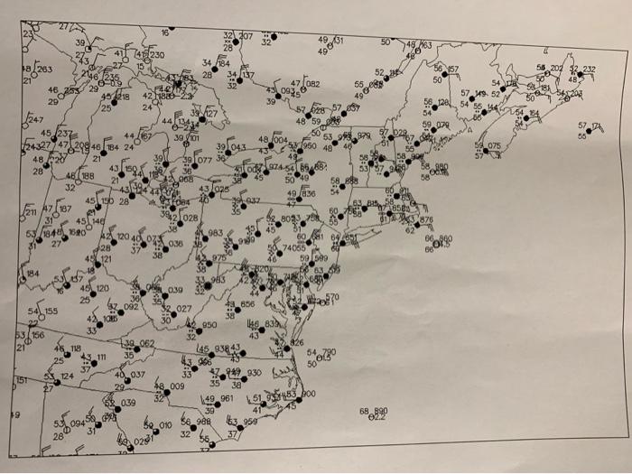
Contour sea level pressure every 4 mb on the weather map. All contour levels should be divisible
Fantastic news! We've Found the answer you've been seeking!
Question:
Contour sea level pressure every 4 mb on the weather map. All contour levels should be divisible by 4 (1000 mb is a good place to start…then do 1004 and 996, 1008, etc.).
NOTE: This storm was exceptionally intense. You will have to draw contours very close together at the storm center (the lowest pressure is being recorded at Atlantic City, New Jersey at this point). Be careful to make your contours clear near the storm center.
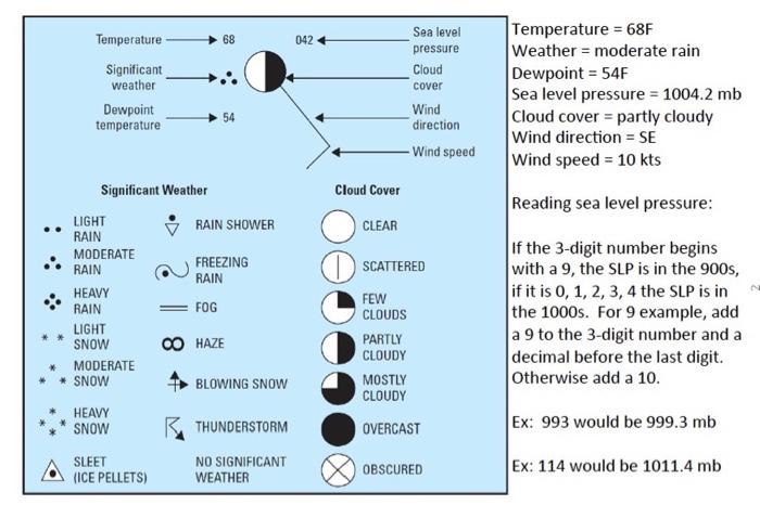
to help read the meaning of the numbers on the map
Expert Answer:
Based on the information you provided here is the interpretation of the numbers on the map Temperature 68F Significant Weather Moderate Rain Dewpoint ... View the full answer

Related Book For 

Financial and Managerial Accounting the basis for business decisions
ISBN: 978-0078111044
16th edition
Authors: Jan Williams, Susan Haka, Mark Bettner, Joseph Carcello
Posted Date:
