

Figure G-35b is a map showing the Johnson Valley Fault in southern California. This is a right-lateral
Question:
Figure G-35b is a map showing the Johnson Valley Fault in southern California. This is a right-lateral strike-slip fault that lies a short distance to the north of the San Andreas Fault zone. On June 28, 1992, one of the largest earthquakes in recent decades occurred on the Johnson Valley Fault, a magnitude 7.5 event named the ‘‘Landers earthquake’’. This large earthquake presumably released shear stress that had accumulated over a long period of time on the Johnson Valley Fault.
Some geologists have suggested that such an accumulation of shear stress on faults can be prevented by injecting water into the fault zone. By increasing the pore pressure, blocks on opposite sides of the fault are permitted to slip continuously past one another, rather than lurching episodically.
Determine the pore pressure required for a fault slip to occur on the Johnson Valley Fault. Regional σ1 in this area is oriented 007°, and estimated to be 10 MPa; μ is 0.4 (Stein et al., 1992). Assume σ3 to be 6 MPa. (Because the rocks are already fractured, draw your failure envelope with straight lines that meet at the origin of the graph, as in Fig. 13.14.)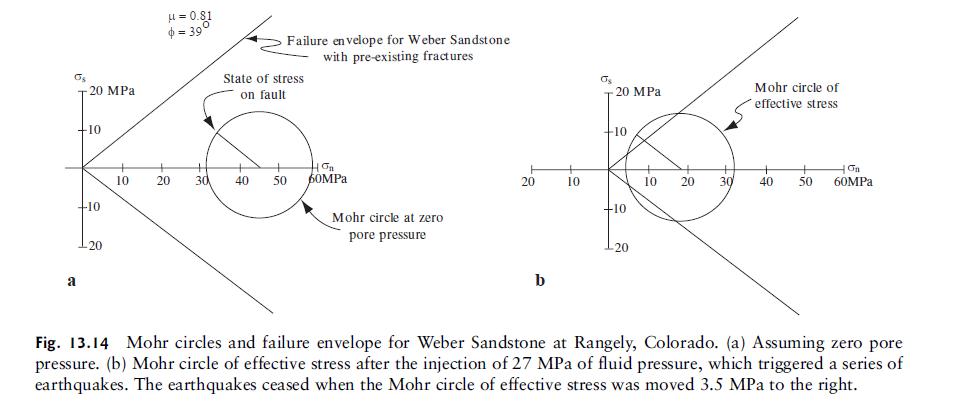
Figure G-35b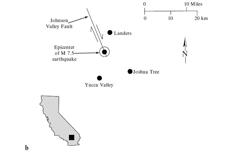
Step by Step Answer:

This question has not been answered yet.
You can Ask your question!


Structural Analysis And Synthesis A Laboratory Course In Structural Geology
ISBN: 9781405116527
3rd Edition
Authors: Stephen M. Rowland, Ernest M. Duebendorfer, Ilsa M. Schiefelbein
