

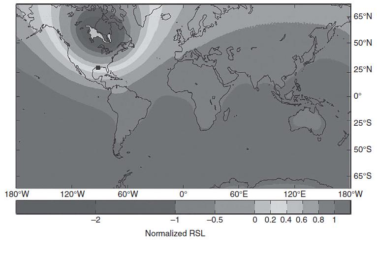
Given the map of the expected response to the Lake Ojibway flood reproduced in Figure 17.15, where
Question:
Given the map of the expected response to the Lake Ojibway flood reproduced in Figure 17.15, where would be a good site to measure the true sea level rise associated with the flood?
Figure 17.15
Fantastic news! We've Found the answer you've been seeking!
Step by Step Answer:
The map in Figure 1715 plots relative sea level rise assoc...View the full answer

Answered By
Amos Kiprotich
I am a wild researcher and I guarantee you a well written paper that is plagiarism free. I am a good time manager and hence you are assured that your paper will always be delivered a head of time. My services are cheap and the prices include a series of revisions, free referencing and formatting.
15+ Reviews
21+ Question Solved
Related Book For 

Geomorphology The Mechanics And Chemistry Of Landscapes
ISBN: 9780521519786
1st Edition
Authors: Robert S. Anderson, Suzanne P. Anderson
Question Posted:
