

Question: 1, 3 & 4? I.) There are two images below. The first is a Snap Shot from Google Earth showing Anchorage. AK and Reykjavik. keland
1, 3 & 4? 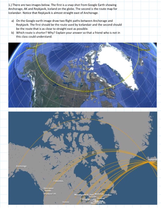
I.) There are two images below. The first is a Snap Shot from Google Earth showing Anchorage. AK and Reykjavik. keland on the globe. The second is the map for Icelandair. Notice that Rey*javik is almost straight east of Anchorage, a) On the Google earth image draw two flight paths between Anchorage and Reykjavik. The first Should be the route used by kelandair and the second Should be the route that is as close to straight east as possible. b) Which route is shorter? Why? Explain your so that a friend who is not in this class could understand.
Step by Step Solution
There are 3 Steps involved in it
1 Expert Approved Answer
Step: 1 Unlock

Question Has Been Solved by an Expert!
Get step-by-step solutions from verified subject matter experts
Step: 2 Unlock
Step: 3 Unlock