

Question: 3. (1 pt) What is the contour interval on Map 3 above? AB 900 feet 800 feet Drumlins |+++ 1000 feet Map 3. 4.
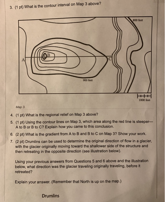
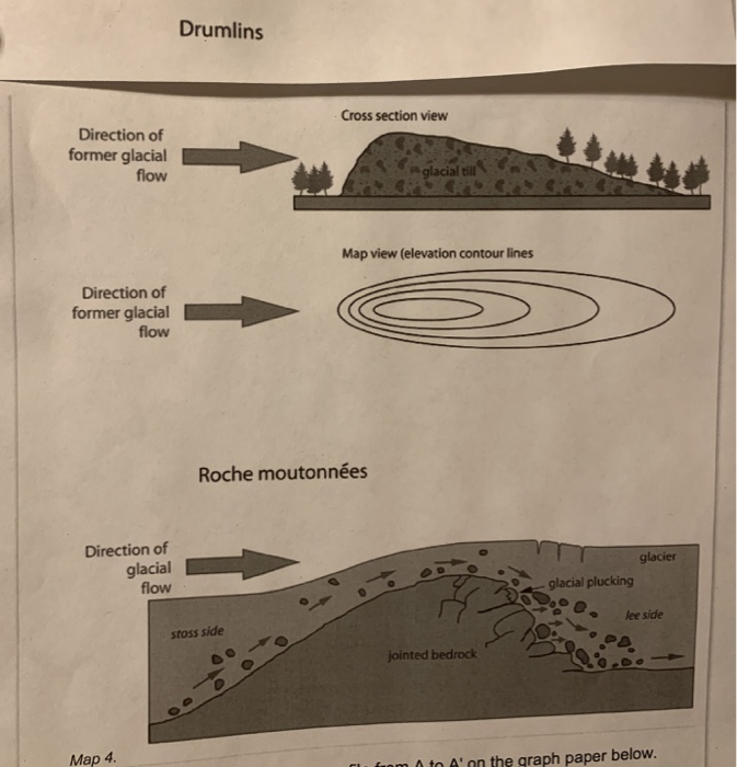
3. (1 pt) What is the contour interval on Map 3 above? AB 900 feet 800 feet Drumlins |+++ 1000 feet Map 3. 4. (1 pt) What is the regional relief on Map 3 above? 5. (1 pt) Using the contour lines on Map 3, which area along the red line is steeper- A to B or B to C? Explain how you came to this conclusion. 6. (2 pt) What is the gradient from A to B and B to C on Map 3? Show your work. 7. (2 pt) Drumlins can be used to determine the original direction of flow in a glacier, with the glacier originally moving toward the shallower side of the structure and then retreating in the opposite direction (see illustration below). Using your previous answers from Questions 5 and 6 above and the illustration below, what direction was the glacier traveling originally traveling, before it retreated? Explain your answer. (Remember that North is up on the map.) Direction of former glacial flow Direction of former glacial flow Direction of glacial flow Map 4. Drumlins Cross section view stoss side Roche moutonnes glacial till Map view (elevation contour lines jointed bedrock glacial plucking glacier lee side from 0 to A' on the graph paper below.
Step by Step Solution
3.44 Rating (160 Votes )
There are 3 Steps involved in it
3 Contour interval is the distance or the difference in the elevation between the two conto... View full answer

Get step-by-step solutions from verified subject matter experts