

Question: */4 The following table gives the map coordinates and the shipping loads for a set of cities that we wish to connect through a
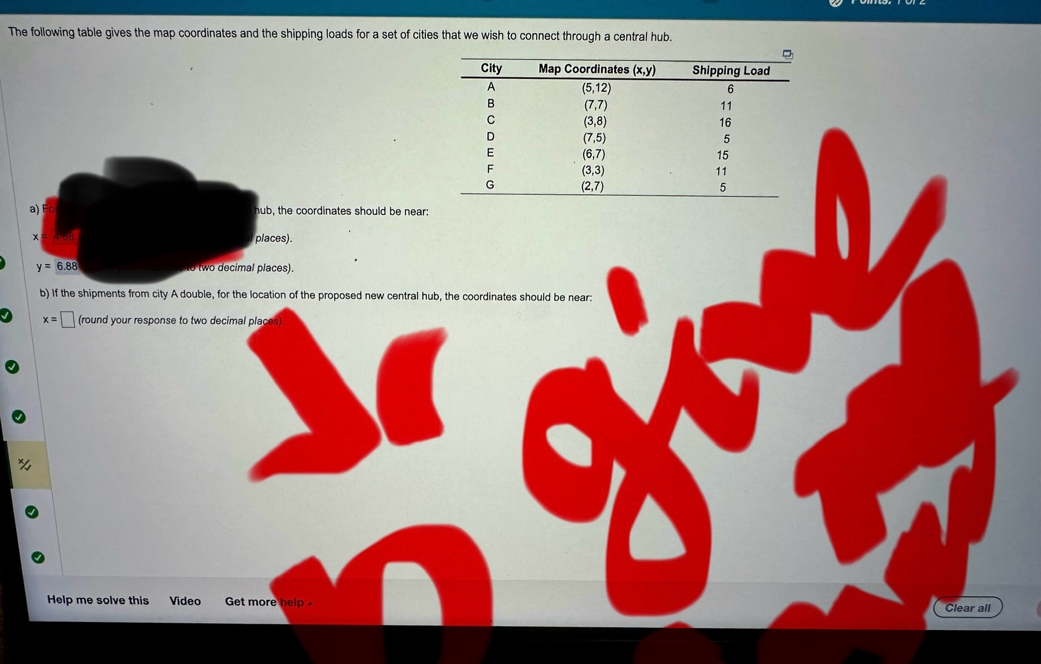
*/4 The following table gives the map coordinates and the shipping loads for a set of cities that we wish to connect through a central hub. a) For X= 4.68 y= 6.88 hub, the coordinates should be near: places). City Map Coordinates (x,y) Shipping Load | < m 0 0 - - 0 A (5,12) 6 B (7,7) 11 C (3,8) 16 D (7,5) 5 E (6,7) 15 F (3,3) 11 (2,7) 5 and your response to two decimal places). b) If the shipments from city A double, for the location of the proposed new central hub, the coordinates should be near: x= (round your response to two decimal places). Help me solve this Video Get more help give Clear all
Step by Step Solution
There are 3 Steps involved in it

Get step-by-step solutions from verified subject matter experts