

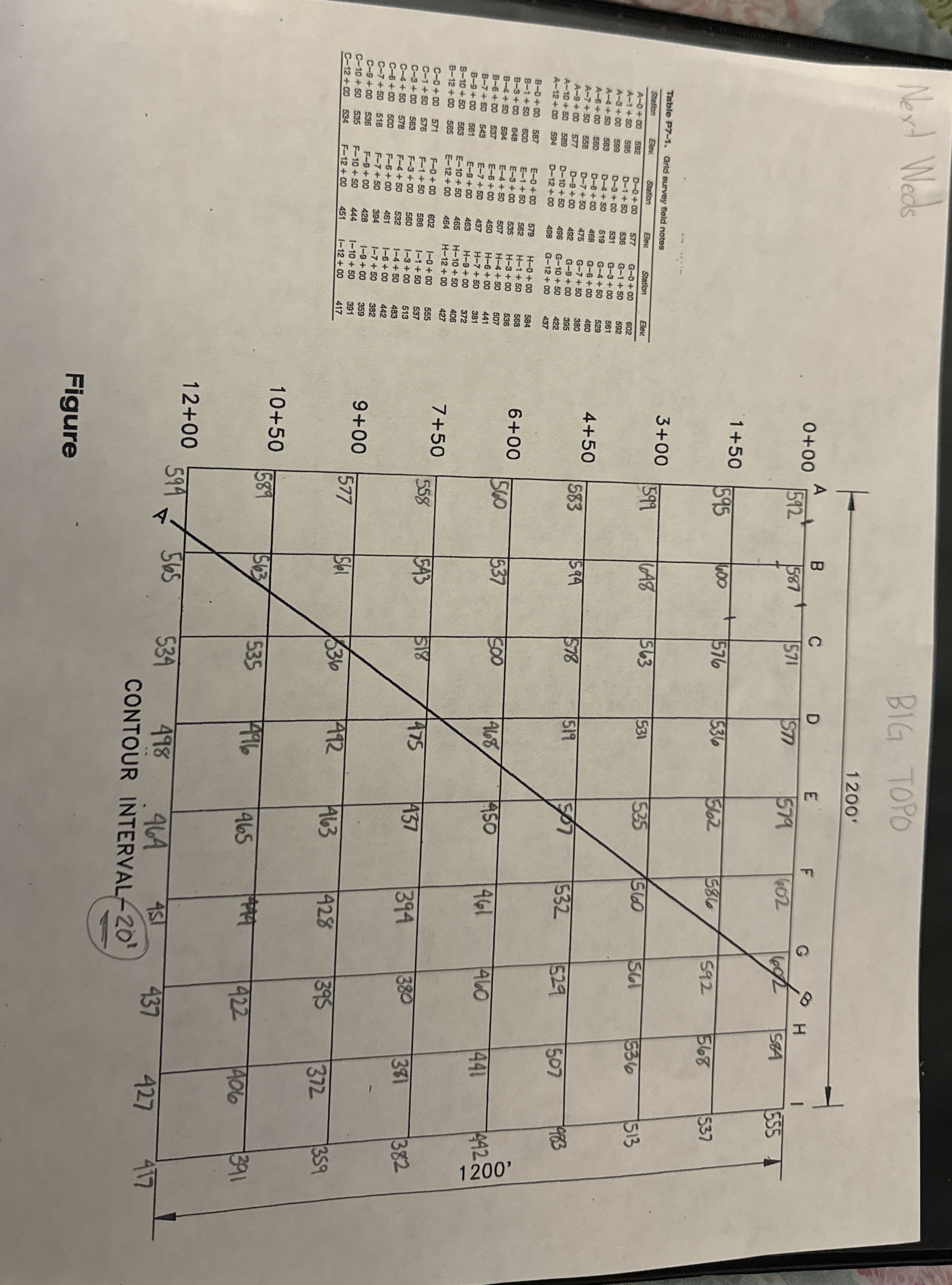
Question: ( a ) Figure 7 - 1 6 . ( a ) For a grid survey, land is divided into a checkerboard and labeled. (
a
Figure a For a grid survey, land is divided into a checkerboard and labeled. b All grid intersections are labeled. c Connect the elevations with curved lines or splines. d Completed contour map of grid survey.
Table Grid survey field notes for the map in Figure
tableStationElev.,Station,Elev.,Station,Elev.
vec
@
Step by Step Solution
There are 3 Steps involved in it
1 Expert Approved Answer
Step: 1 Unlock

Question Has Been Solved by an Expert!
Get step-by-step solutions from verified subject matter experts
Step: 2 Unlock
Step: 3 Unlock