

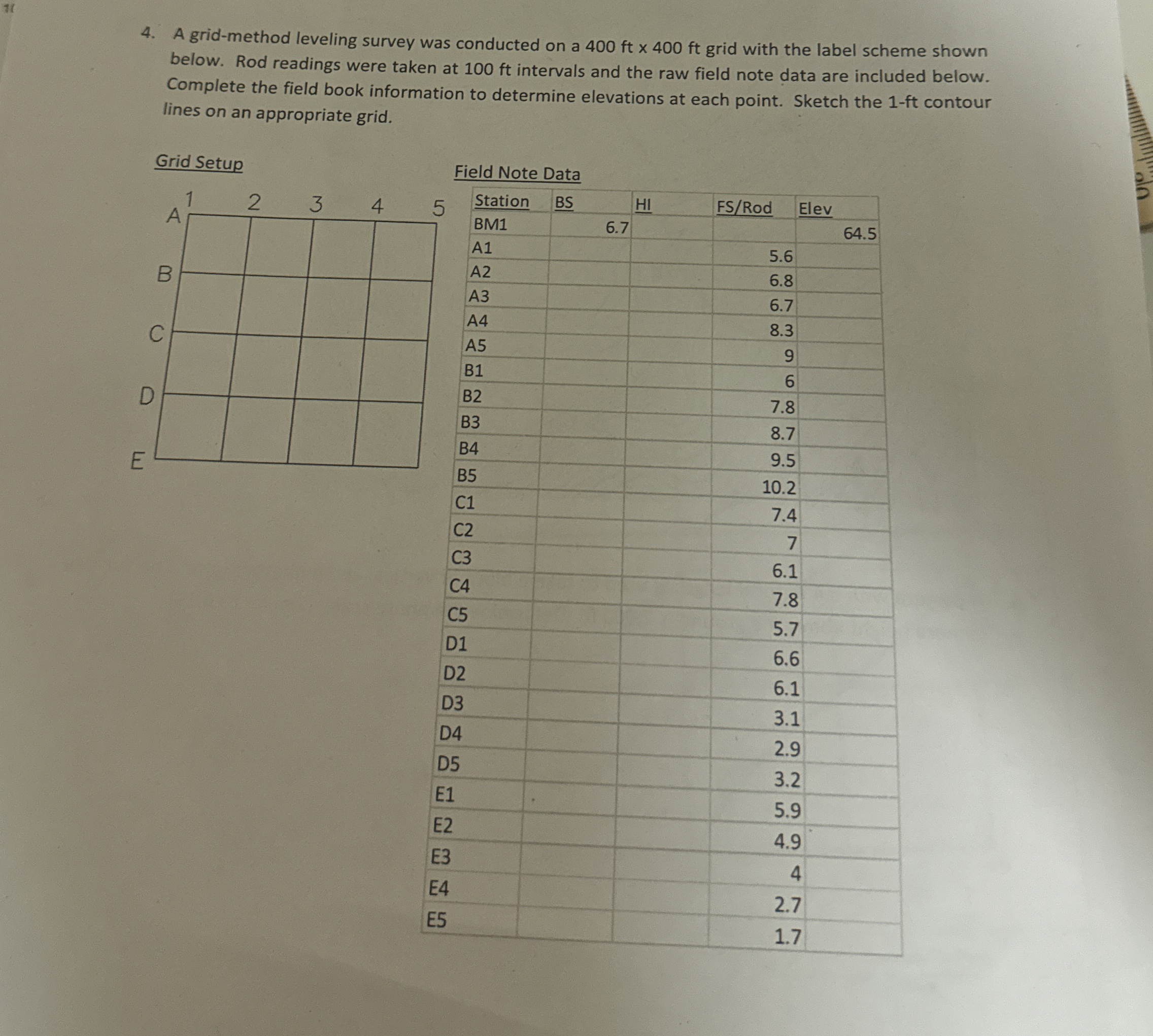
Question: A grid - method leveling survey was conducted on a 4 0 0 f t 4 0 0 f t grid with the label scheme
A gridmethod leveling survey was conducted on a grid with the label scheme shown below. Rod readings were taken at ft intervals and the raw field note data are included below. Complete the field book information to determine elevations at each point. Sketch the ft contour lines on an appropriate grid.
Field Note Data
tableStationBSHI FSRod EElevBMAAAAABBBBBCCCCCDDDDDEEEEEE
Step by Step Solution
There are 3 Steps involved in it
1 Expert Approved Answer
Step: 1 Unlock

Question Has Been Solved by an Expert!
Get step-by-step solutions from verified subject matter experts
Step: 2 Unlock
Step: 3 Unlock