

Question: a ) ( o points ) For any given surface distance and latitude; as the elevation increases, the grid distance ( increases or decreases? )
ao points For any given surface distance and latitude; as the elevation increases, the grid distance increases or decreases?
b points Can the grid distance be greater than surface distance? Briefly, explain why.
points What are the three segments of the GPS Briefly, describe the function of each one of these segments.
Lidar Study lecture
points List the components of a mobile Lidar system and identify the purposes of each component.
Earthwork Volumes Study sections in the book and lecture
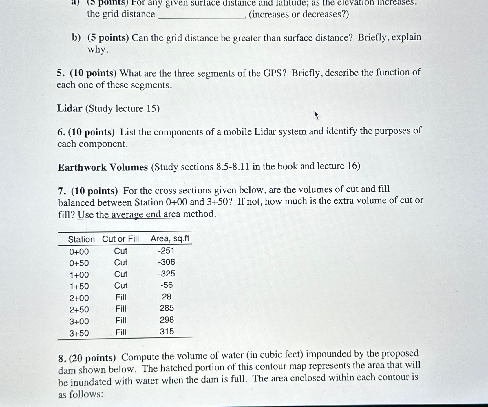
points For the cross sections given below, are the volumes of cut and fill balanced between Station and If not, how much is the extra volume of cut or fill? Use the average end area method.
tableStationCut or Fill,Area, sqftCut,Cut,Cut,Cut,Fill,Fill,Fill,Fill,
points Compute the volume of water in cubic feet impounded by the proposed dam shown below. The hatched portion of this contour map represents the area that will be inundated with water when the dam is full. The area enclosed within each contour is as follows:
Step by Step Solution
There are 3 Steps involved in it
1 Expert Approved Answer
Step: 1 Unlock

Question Has Been Solved by an Expert!
Get step-by-step solutions from verified subject matter experts
Step: 2 Unlock
Step: 3 Unlock