

Question: a . Which environmental conditions and civil risks do you need to consider in for a renewable energy project? b . Which design inputs and
a Which environmental conditions and civil risks do you need to consider in for a renewable energy project?
b Which design inputs and studies do you require to commence a civil engineering project?
Topography:
a Which different topographical survey methods and equipment are you familiar with? Which would be suitable for conceptual, preliminary & detailed designs respectively?
b What can you tell us about different coordinate systems and projections used in topography and GIS? How would you go about converting your design from one system to another?
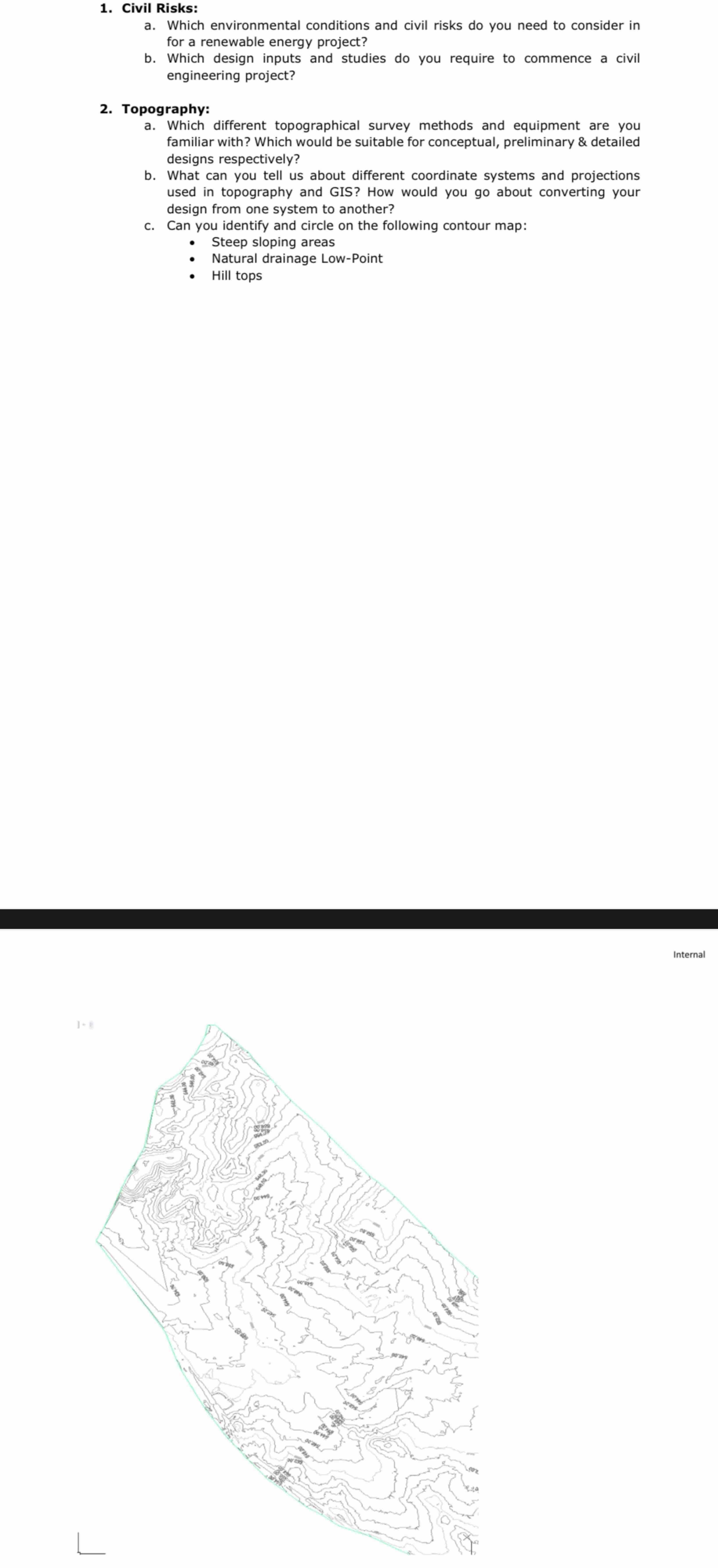
c Can you identify and circle on the following contour map:
Steep sloping areas
Natural drainage LowPoint
Hill tops
Step by Step Solution
There are 3 Steps involved in it
1 Expert Approved Answer
Step: 1 Unlock

Question Has Been Solved by an Expert!
Get step-by-step solutions from verified subject matter experts
Step: 2 Unlock
Step: 3 Unlock