

Question: Contouring Data Exercise On Map E , draw contours to fit the data shown. Label all contours. Note: To simplify the exercise, distances of elevation
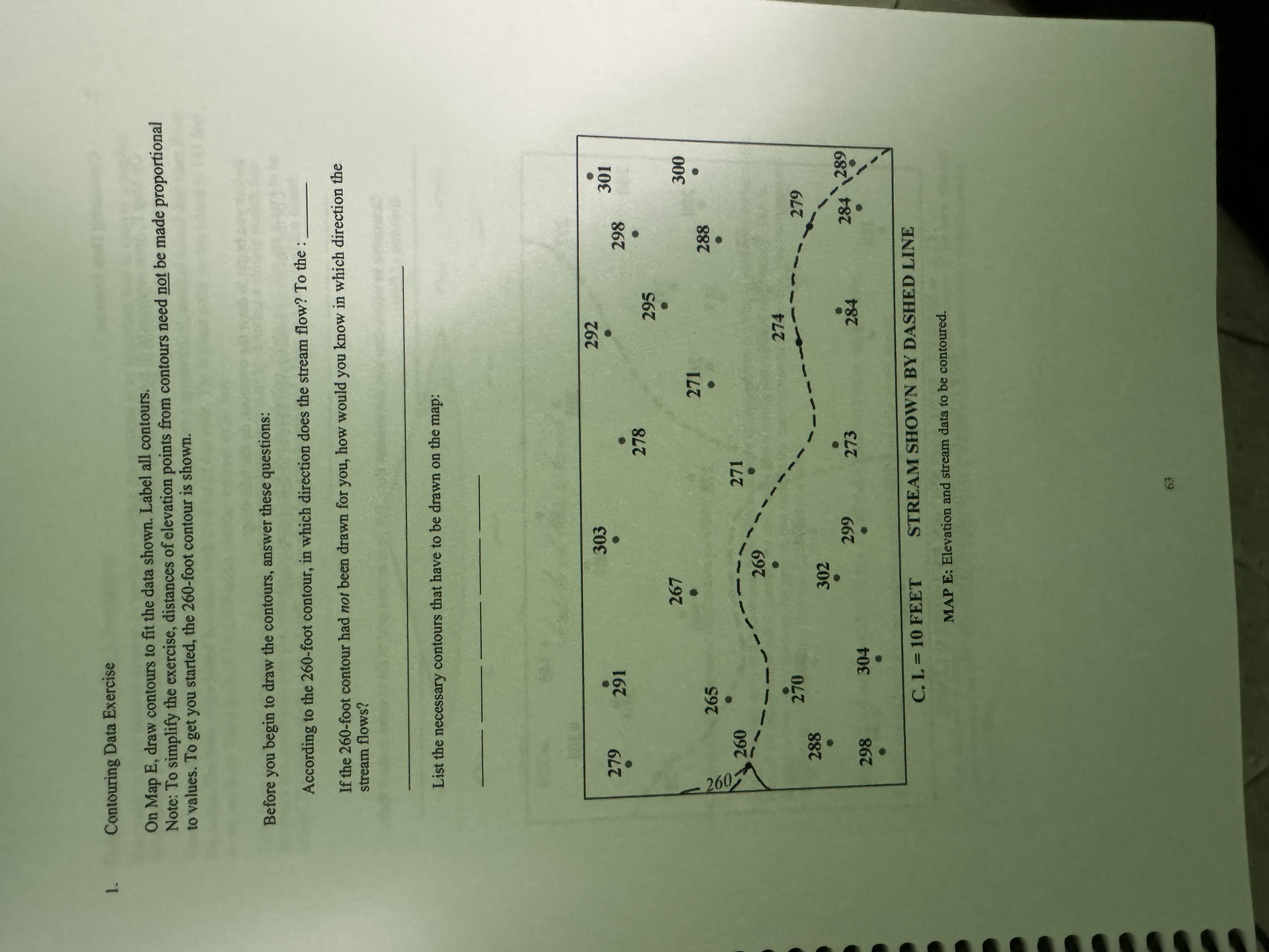
Contouring Data Exercise
On Map E draw contours to fit the data shown. Label all contours.
Note: To simplify the exercise, distances of elevation points from contours need not be made proportional to values. To get you started, the foot contour is shown.
Before you begin to draw the contours, answer these questions:
According to the foot contour, in which direction does the stream flow? To the :
If the foot contour had nor been drawn for you, how would you know in which direction the stream flows?
List the necessary contours that have to be drawn on the map:
C FEET
STREAM SHOWN BY DASHED LINE
MAP E: Elevation and stream data to be contoured.
Step by Step Solution
There are 3 Steps involved in it
1 Expert Approved Answer
Step: 1 Unlock

Question Has Been Solved by an Expert!
Get step-by-step solutions from verified subject matter experts
Step: 2 Unlock
Step: 3 Unlock