

Question: Data for station Zeus. Determine the SPC grid azimuth from Station GAM to Station Zeus and calculate the following distances between the two points: grid
Data for station Zeus.
Determine the SPC grid azimuth from Station GAM to Station Zeus and calculate the following distances between the two points: grid distance, geodetic distance, and topographic distance. Assume an average geoidal height of meters, an average orthometric height of ift, and a grid scale factor of
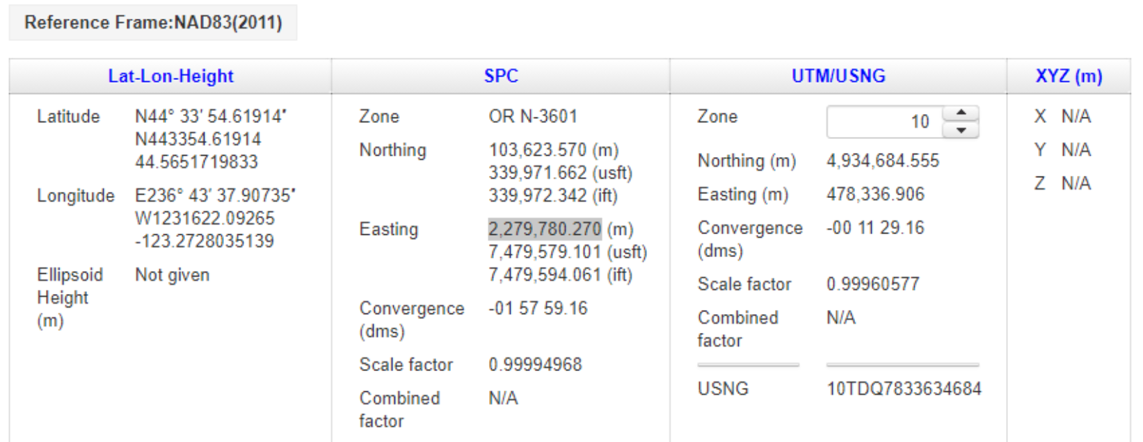
Information about station GAM is shown below:
Station GAM has a latitude, Phi deg N and a longitude, lambda deg W The Oregon north zone State Plane Coordinate are: N m or ift and E m or ift.
Step by Step Solution
There are 3 Steps involved in it
1 Expert Approved Answer
Step: 1 Unlock

Question Has Been Solved by an Expert!
Get step-by-step solutions from verified subject matter experts
Step: 2 Unlock
Step: 3 Unlock