

Question: Determine the location using physics calculations to solve the problem. Show step by step details for how you solved the problem. I don't need an
Determine the location using physics calculations to solve the problem. Show step by step details for how you solved the problem. I don't need an explanation explaining how to solve the problem. T
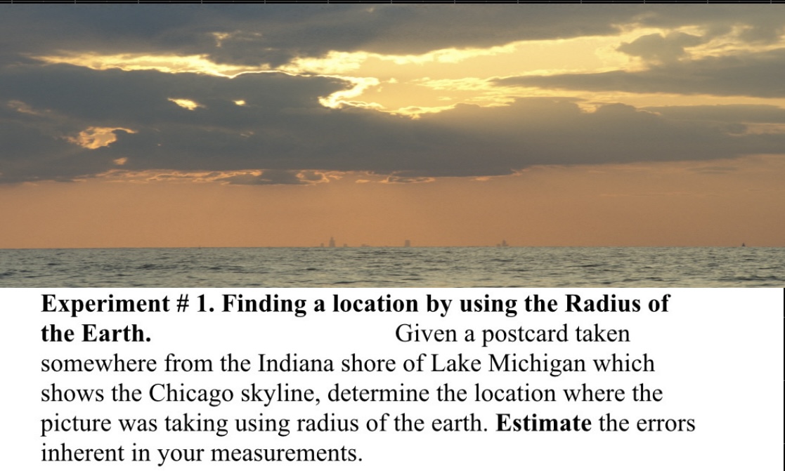
By previous experience with the postcard, it has been concluded that the location of the picture listed on the is east of the port of Indiana or the Northern Indiana Public Service Co., west of Dune Acres along the beach front, close to the Cowles Bog Trail. There are several ways to determine distances along the surface of the earth. Road maps, navigation maps, or Geological survey maps can be used. On the Web there is a surface called mapquest.com which will draw a map centered on a longitude and latitude that have been entered in the program by successive approximation it is possible to find the latitude and longitude of any spot. If the spots are just odd shore in Lake Michigan, it is possible to use a program at www.gosail.com/nav.html which will calculate the surface distance and heading between any two sites on Lake Michigan which can be located by latitude and longitude. The most important part of this experiment is the estimation of error in each measurement and the report of the location where the picture was taken with a discussion of the uncertainty.
Step by Step Solution
There are 3 Steps involved in it

Get step-by-step solutions from verified subject matter experts