

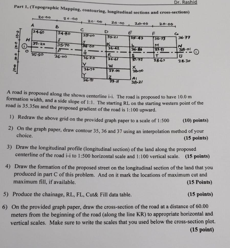
Question: Dr . Rashid Part 1 , ( Topographic Mapping, contouring, longitudinal sections and cross - sections ) A road is proposed along the shown centerline
Dr Rashid
Part Topographic Mapping, contouring, longitudinal sections and crosssections
A road is proposed along the shown centerline The road is proposed to have formation width, and a side slope of : The starting RL on the starting western point of the road is and the proposed gradient of the road is : upward.
Redraw the above grid on the provided graph paper to a scale of :
points
On the graph paper, draw contour and using an interpolation method of your choice.
points
Draw the longitudinal profile longitudinal section of the land along the proposed centerline of the road ii to : horizontal scale and : vertical scale. points
Draw the formation of the proposed street on the longitudinal section of the land that you produced in part of this problem. And on it mark the locations of maximum cut and maximum fill, if available.
Points
Produce the chainage, RL FL Cut& Fill data table.
points
On the provided graph paper, draw the crosssection of the road at a distance of meters from the beginning of the road along the line KR to appropriate horizontal and vertical scales. Make sure to write the scales that you used below the crosssection plot.
point
Step by Step Solution
There are 3 Steps involved in it
1 Expert Approved Answer
Step: 1 Unlock

Question Has Been Solved by an Expert!
Get step-by-step solutions from verified subject matter experts
Step: 2 Unlock
Step: 3 Unlock