

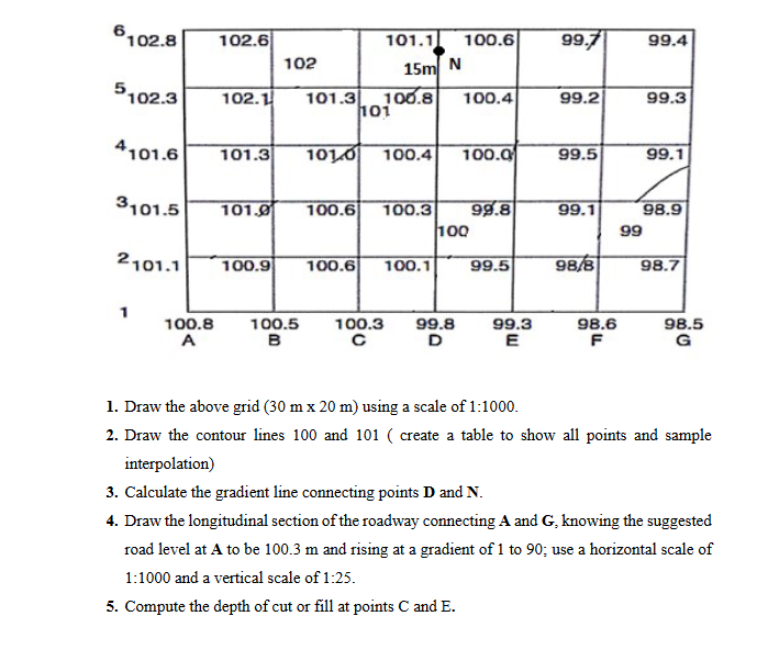
Question: Draw the above grid ( 3 0 m 2 0 m ) using a scale of 1 : 1 0 0 0 . Draw the
Draw the above grid using a scale of :
Draw the contour lines and create a table to show all points and sample
interpolation
Calculate the gradient line connecting points and
Draw the longitudinal section of the roadway connecting A and knowing the suggested
road level at to be and rising at a gradient of to ; use a horizontal scale of
: and a vertical scale of :
Compute the depth of cut or fill at points and
Step by Step Solution
There are 3 Steps involved in it
1 Expert Approved Answer
Step: 1 Unlock

Question Has Been Solved by an Expert!
Get step-by-step solutions from verified subject matter experts
Step: 2 Unlock
Step: 3 Unlock