

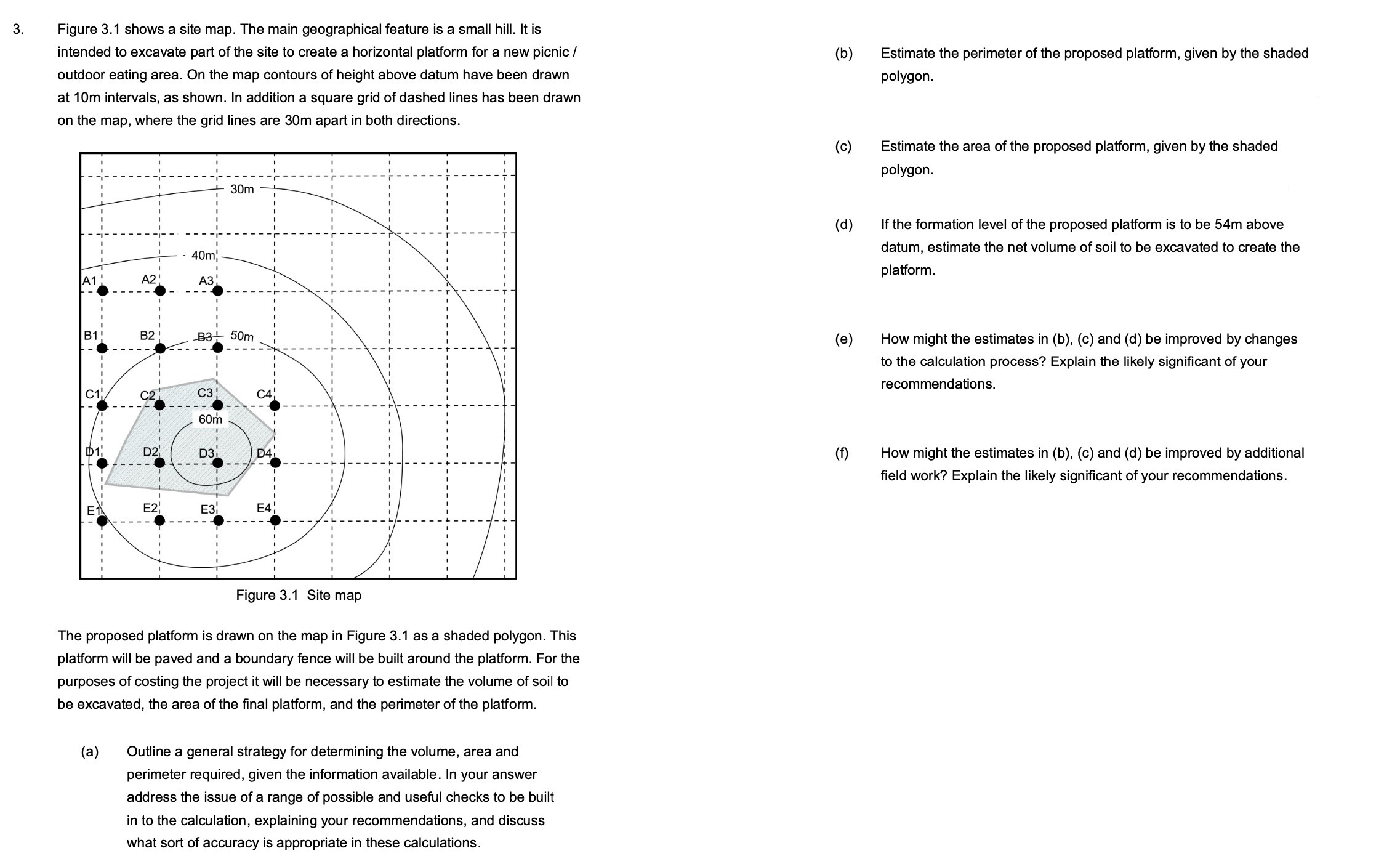
Question: Figure 3 . 1 shows a site map. The main geographical feature is a small hill. It is intended to excavate part of the site
Figure shows a site map. The main geographical feature is a small hill. It is intended to excavate part of the site to create a horizontal platform for a new picnic outdoor eating area. On the map contours of height above datum have been drawn at m intervals, as shown. In addition a square grid of dashed lines has been drawn on the map, where the grid lines are m apart in both directions.
The proposed platform is drawn on the map in Figure as a shaded polygon. This platform will be paved and a boundary fence will be built around the platform. For the purposes of costing the project it will be necessary to estimate the volume of soil to be excavated, the area of the final platform, and the perimeter of the platform.
a Outline a general strategy for determining the volume, area and perimeter required, given the information available. In your answer address the issue of a range of possible and useful checks to be built in to the calculation, explaining your recommendations, and discuss what sort of accuracy is appropriate in these calculations.
b Estimate the perimeter of the proposed platform, given by the shaded polygon.
c Estimate the area of the proposed platform, given by the shaded polygon.
d If the formation level of the proposed platform is to be m above datum, estimate the net volume of soil to be excavated to create the platform.
e How might the estimates in bc and d be improved by changes to the calculation process? Explain the likely significant of your recommendations.
f How might the estimates in bc and d be improved by additional field work? Explain the likely significant of your recommendations.
Step by Step Solution
There are 3 Steps involved in it
1 Expert Approved Answer
Step: 1 Unlock

Question Has Been Solved by an Expert!
Get step-by-step solutions from verified subject matter experts
Step: 2 Unlock
Step: 3 Unlock