

Question: Scenario An existing path is to be converted into a paved road, but its alignment needs to be plotted correctly to avoid certain obstacles
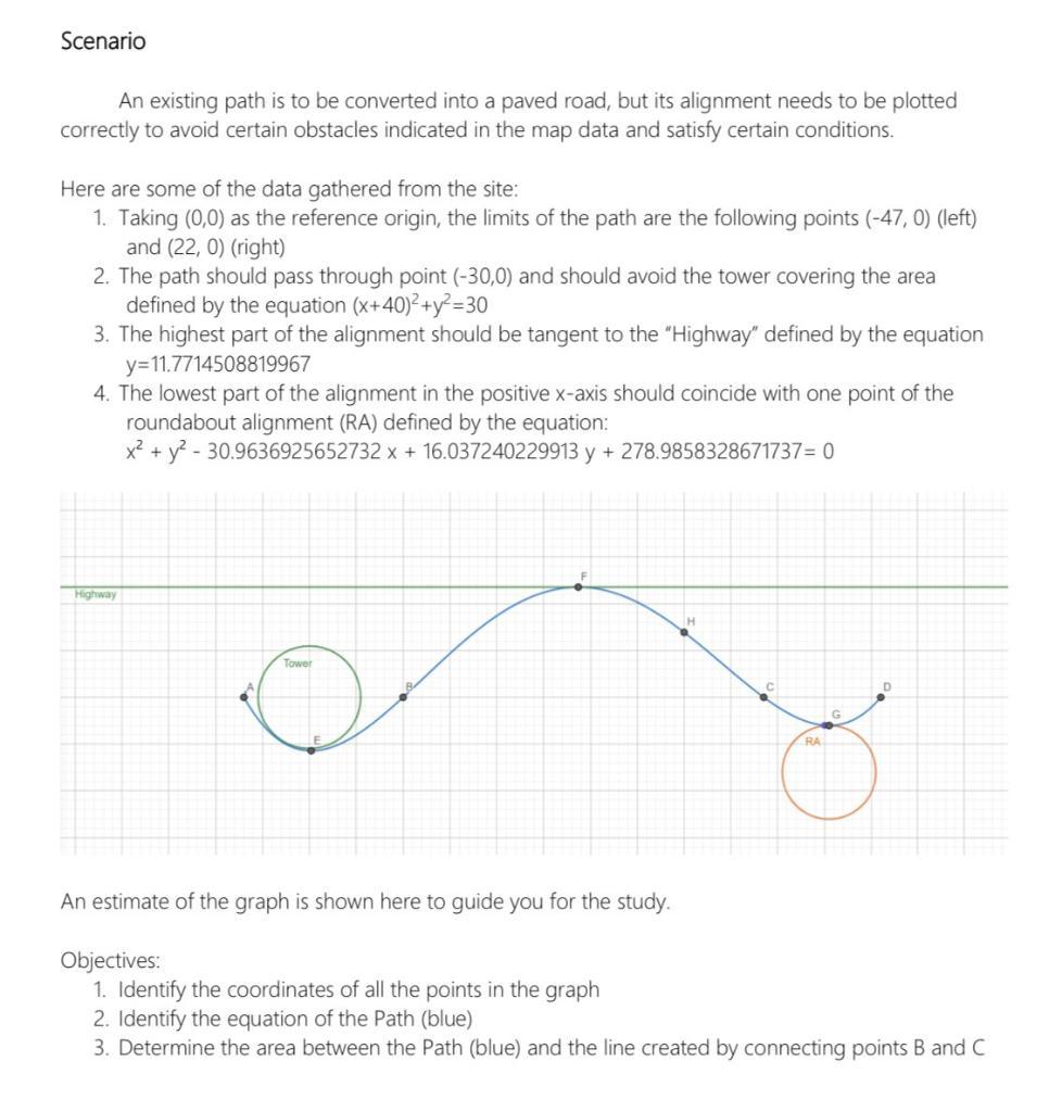
Scenario An existing path is to be converted into a paved road, but its alignment needs to be plotted correctly to avoid certain obstacles indicated in the map data and satisfy certain conditions. Here are some of the data gathered from the site: 1. Taking (0,0) as the reference origin, the limits of the path are the following points (-47, 0) (left) and (22, 0) (right) 2. The path should pass through point (-30,0) and should avoid the tower covering the area defined by the equation (x+40)+y=30 3. The highest part of the alignment should be tangent to the "Highway" defined by the equation y=11.7714508819967 4. The lowest part of the alignment in the positive x-axis should coincide with one point of the roundabout alignment (RA) defined by the equation: x + y - 30.9636925652732 x + 16.037240229913 y + 278.9858328671737= 0 Highway Tower E H RA G An estimate of the graph is shown here to guide you for the study. Objectives: 1. Identify the coordinates of all the points in the graph 2. Identify the equation of the Path (blue) 3. Determine the area between the Path (blue) and the line created by connecting points B and C
Step by Step Solution
3.46 Rating (159 Votes )
There are 3 Steps involved in it

Get step-by-step solutions from verified subject matter experts