

In ArcGIS we were asked: Determine the number of stores per 100,000 people in each state, using
Question:
In ArcGIS we were asked:
Determine the number of stores per 100,000 people in each state, using the POP2014 field. Which state has the most stores per capita? Which has the least? (Hint: In a joined table, only the target table fields may be calculated.)
This step has been completed. After joining the tables and compiling the data successfully, we were then asked to:
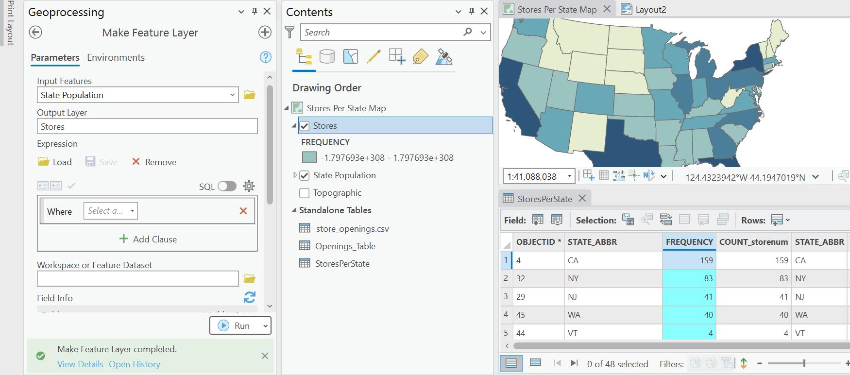
Capture a map showing the number of stores in each state; include a legend in the map. Also capture a map showing the number of stores per capita in each state. Compare the two maps and discuss what they could mean.
I have not been able to figure out how to take the data from the new table and create a working layer. The tool creates a layer with unusable numbers as shown in the image. Please advise on what I'm doing incorrectly.
Thanks
Expert Answer:


Understanding Business Ethics
ISBN: 9781506303239
3rd Edition
Authors: Peter A. Stanwick, Sarah D. Stanwick
