

Question: Interpolation in topographic mapping means:Connecting points of the same elevation.b . Blowing up or reducing the map scaleC.Spacing contour lines by proportionate measurements.d . Drawing
Interpolation in topographic mapping means:Connecting points of the same elevation.bBlowing up or reducing the map scaleC.Spacing contour lines by proportionate measurements.d Drawing contour lines through points of known elevation.e NoneMmm
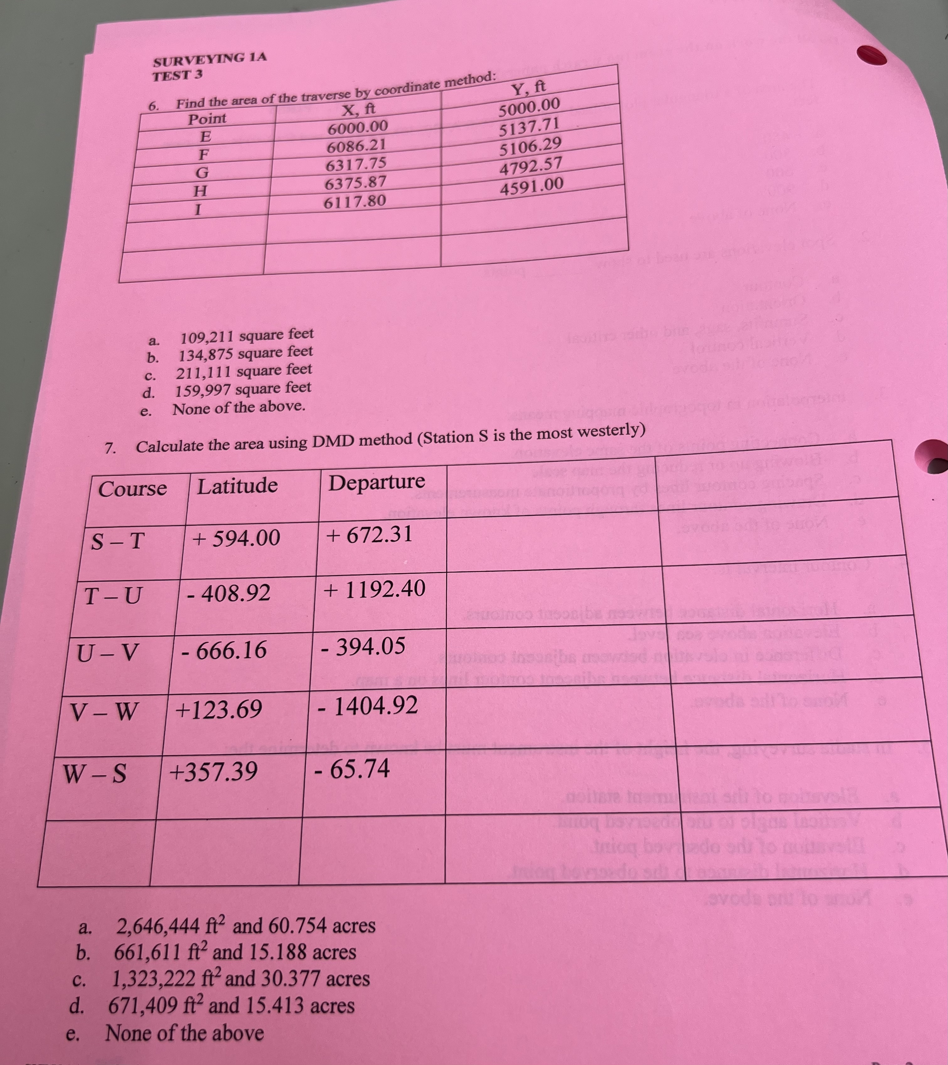
SURVEYING A
TEST
Find the area of the traverse by coordinate method:
a square feet
b square feet
c square feet
d square feet
e None of the above.
Calculate the area using DMD method Station S is the most westerly
tableCourseLatitude,Departure,,S TTUUVV WW S
a and acres
b and acres
c and acres
d and acres
e None of the above
Step by Step Solution
There are 3 Steps involved in it
1 Expert Approved Answer
Step: 1 Unlock

Question Has Been Solved by an Expert!
Get step-by-step solutions from verified subject matter experts
Step: 2 Unlock
Step: 3 Unlock