

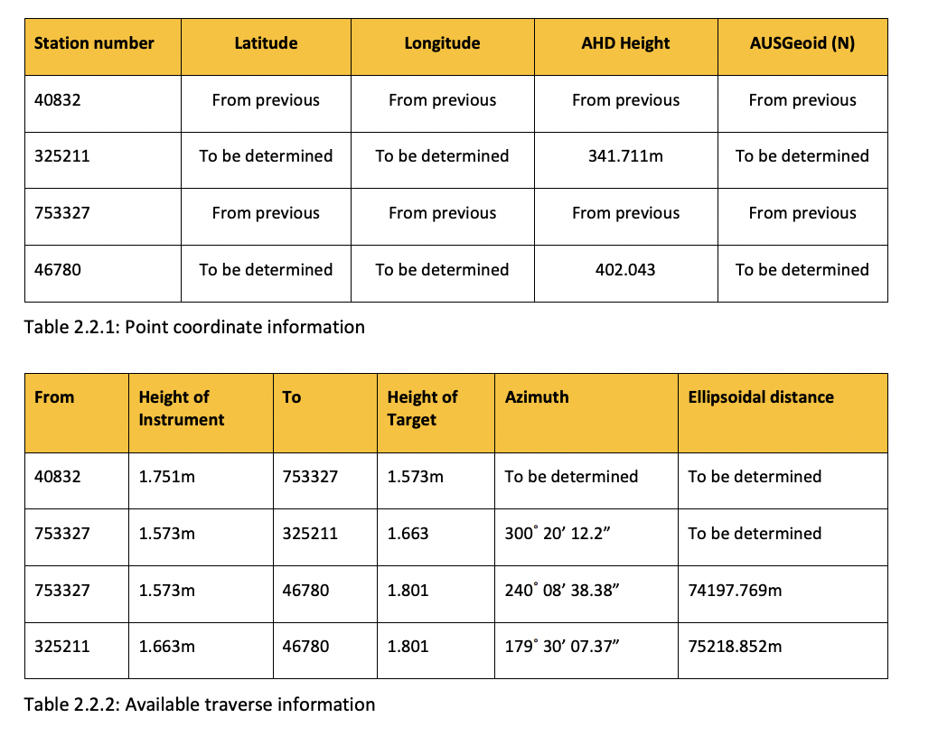
Question: Part of your work will be using survey control from surrounding towns in the event there are to be satellite campuses. Two permanent marks have
Part of your work will be using survey control from surrounding towns in the event there are to be
satellite campuses. Two permanent marks have been identified as being needed, and as they have
been determined as unsuitable for GNSS the have been traversed. The traverse information is as
shown below in Table and Table All coordinates are in GDA and the deflection of
the vertical for each can assume to have been corrected.
Using the data provided in Tables and along with your results from Task develop an
appropriate sketch hand drawn is ok to show all the data clearly.
Ensure all the stations and lines are clearly annotated with the data associated with them, and that
provided information is clearly distinguished from calculated or determined data
Step by Step Solution
There are 3 Steps involved in it
1 Expert Approved Answer
Step: 1 Unlock

Question Has Been Solved by an Expert!
Get step-by-step solutions from verified subject matter experts
Step: 2 Unlock
Step: 3 Unlock