

Question: PLEASE HELP PART A: Theory . True or False (Circle the correct answer) (10 Points) 1. True False Scale bar is the most important map
PLEASE HELP
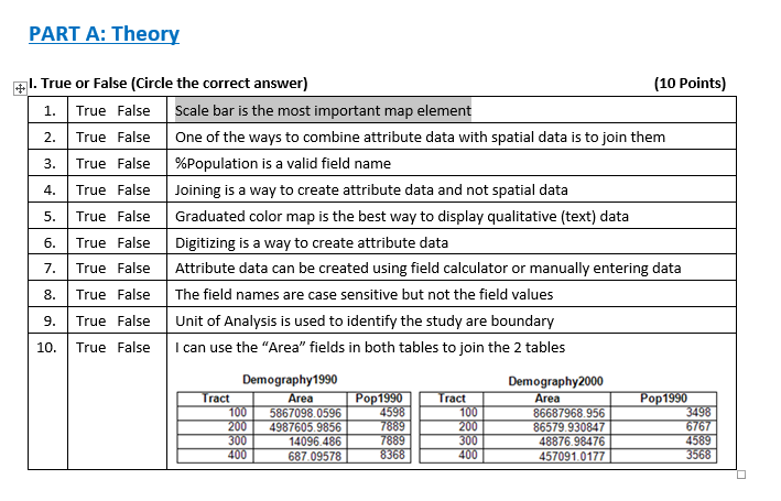
PART A: Theory . True or False (Circle the correct answer) (10 Points) 1. True False Scale bar is the most important map element 2. True False One of the ways to combine attribute data with spatial data is to join them 3. | True False | %population is a valid field name 4.True False Joining is a way to create attribute data and not spatial data 5.True False Graduated color map is the best way to display qualitative (text) data 6. True False Digitizing is a way to create attribute data 7. True False Attribute data can be created using field calculator or manually entering data 8. True False The field names are case sensitive but not the field values 9. True False Unit of Analysis is used to identify the study are boundary 10. True False I can use the "Area" fields in both tables to join the 2 tables Demography1990 Demography2000 TractArea Area 1005867098 0596 4598 86687968.956 0847 4-308 31 400687 09578 457091.0177
Step by Step Solution
There are 3 Steps involved in it

Get step-by-step solutions from verified subject matter experts