

Question: please help! please put all step The following table gives the map coordinates and the shipping loads for a set of cities that we wish
please help! please put all step 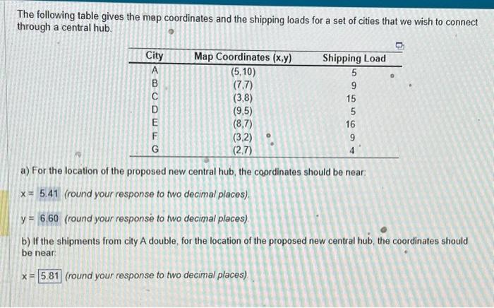
The following table gives the map coordinates and the shipping loads for a set of cities that we wish to connect through a central hub. a) For the location of the proposed new central hub, the coordinates should be near: x=5.41 (round your response to two decimal places). y= (round your response to two decimal places). b) If the shipments from city A double, for the location of the proposed new central hub, the coordinates should be near: x= (round your response to two decimal places)
Step by Step Solution
There are 3 Steps involved in it
1 Expert Approved Answer
Step: 1 Unlock

Question Has Been Solved by an Expert!
Get step-by-step solutions from verified subject matter experts
Step: 2 Unlock
Step: 3 Unlock