

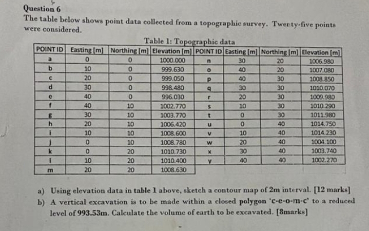
Question: Question 6 The table below shows point data collected from a topographic survey. Twenty - five points were considered. Table 1 : Topographic data
Question
The table below shows point data collected from a topographic survey. Twentyfive points were considered.
Table : Topographic data
tablePOINTIDEasting mNorthing mElevation mPOINTID,Easting mNorthing mElevation manbcpdqerghijwkym
a Using elevation data in table above, sketch a contour map of m interval. marks
b A vertical excavation is to be made within a closed polygon ceomc to a reduced level of m Calculate the volume of earth to be excavated. marks
Step by Step Solution
There are 3 Steps involved in it
1 Expert Approved Answer
Step: 1 Unlock

Question Has Been Solved by an Expert!
Get step-by-step solutions from verified subject matter experts
Step: 2 Unlock
Step: 3 Unlock