

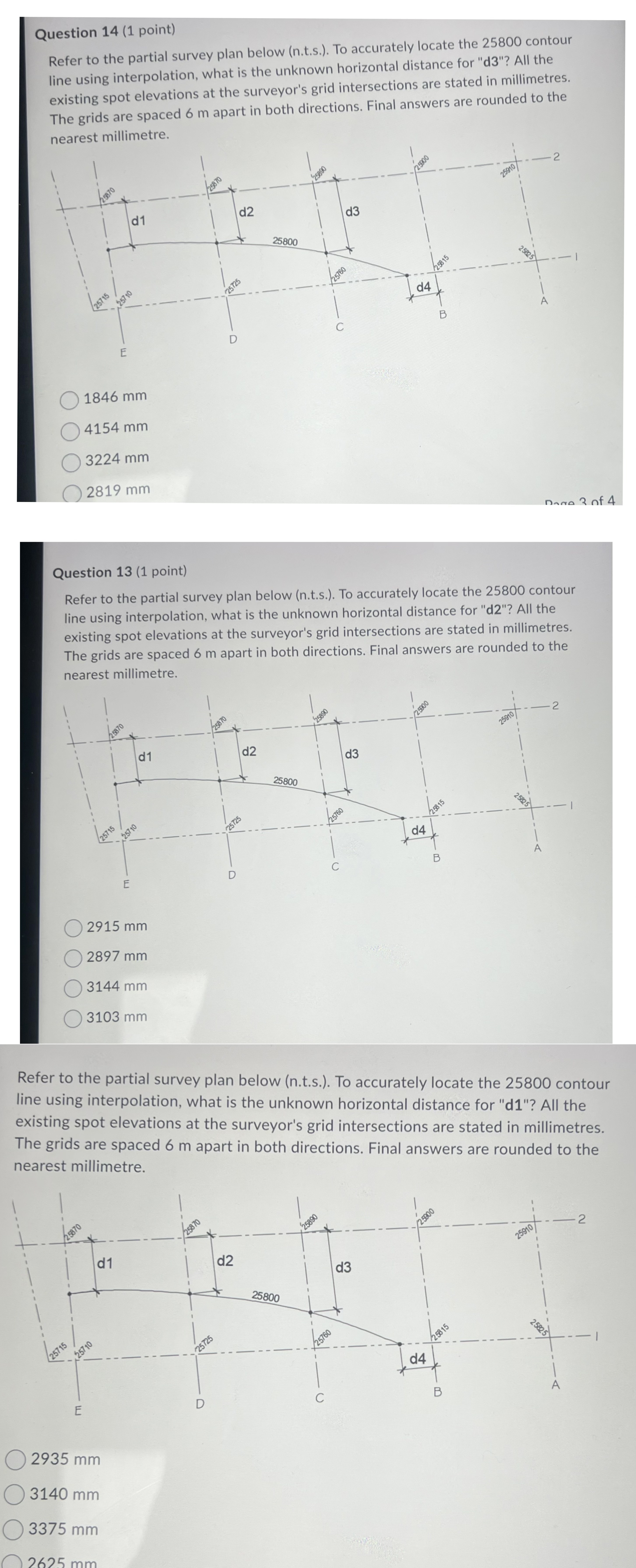
Question: Refer to the partial survey plan below ( n . t . s . ) . To accurately locate the 2 5 8 0 0
Refer to the partial survey plan below nts To accurately locate the contour
line using interpolation, what is the unknown horizontal distance for d All the
existing spot elevations at the surveyor's grid intersections are stated in millimetres.
The grids are spaced m apart in both directions. Final answers are rounded to the
nearest millimetre.
mm
mm
mm
Step by Step Solution
There are 3 Steps involved in it
1 Expert Approved Answer
Step: 1 Unlock

Question Has Been Solved by an Expert!
Get step-by-step solutions from verified subject matter experts
Step: 2 Unlock
Step: 3 Unlock