

Question: Requires you map out an area and plot that area in the Cartesian coordinate system. Below is an example Use your backyard or a friend
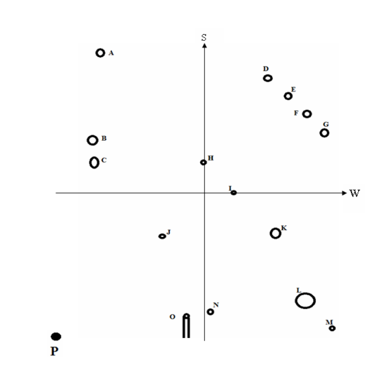
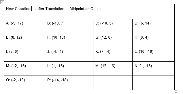
Requires you map out an area and plot that area in the Cartesian coordinate system. Below is an example
Use your backyard or a friend or family member's yard (or a park, school playground, etc.), and pace off (or measure) the area to obtain the measurements of that area. If you are pacing off the area make sure to determine your pace step length as that will be the scale for your coordinate system. Initially mark the lower left hand corner of the area as the origin of your coordinate system. This will be the coordinates (0, 0). Pace off all items in the area (chairs, tables, trees, pool, sandbox, swing set, grill, etc.), and then plot them in your coordinate system. See the example below. Notice how the items are marked as A, B, C, and so on, and then the coordinates are given underneath the diagram. You can use Paint, Word, or any drawing program (or draw it by hand and scan it in) to create the coordinate system with items added. Be creative or just make circles/dots like the drawing below.


Step by Step Solution
There are 3 Steps involved in it

Get step-by-step solutions from verified subject matter experts