

Question: The HTML Geolocation API is used to get the geographical position of a user. It allows the user to provide their location to web applications
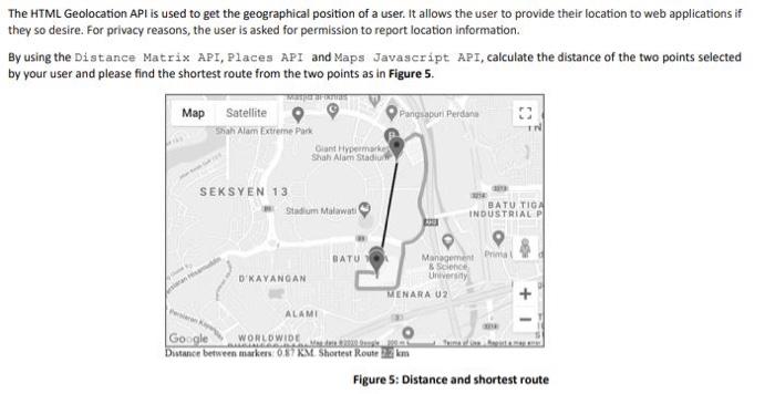
The HTML Geolocation API is used to get the geographical position of a user. It allows the user to provide their location to web applications if they so desire. For privacy reasons, the user is asked for permission to report location information. By using the Distance Matrix API, Places API and Maps Javascript API, calculate the distance of the two points selected by your user and please find the shortest route from the two points as in Figure 5. IN Map Satellite Pangsapuri Perdana Shah Alam Extreme Park Giant Hypermarket Shah Alam Stadium SEKSYEN 13 Stadium Malawat BATU TIGA INDUSTRIAL P BATU D'KAYANGAN Management Pria 85cence University MENARA U2 + 1 ALAMI Google WORLDWIDE w Distance between markers: 057KM Shortest Route 22 km Figure 5: Distance and shortest route
Step by Step Solution
There are 3 Steps involved in it

Get step-by-step solutions from verified subject matter experts