

Question: the second image is just a sample to show the type of questions needed to be answered for this question. The following table gives the
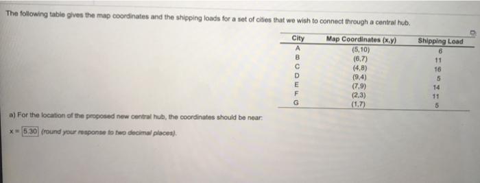
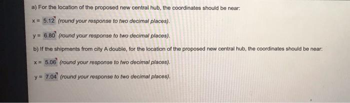
The following table gives the map coordinates and the shipping loads for a set of cities that we wish to connect through a central hub. Map Coordinates (x,y) (5,10) (6,7) (4.8) (9.4) (7,9) (2,3) (1,7) a) For the location of the proposed new central hub, the coordinates should be near * = 5:30 (round your response to two decimal places) City B D E F G Shipping Load 6 11 16 5 14 11 5 a) For the location of the proposed new central hub, the coordinates should be near: x = 5.12 (round your response to two decimal places). y = 6.80 (round your response to two decimal places). b) If the shipments from city A double, for the location of the proposed new central hub, the coordinates should be near: * = 5.06 (round your response to two decimal places). y= 7.04 (round your response to two decimal places)
Step by Step Solution
There are 3 Steps involved in it

Get step-by-step solutions from verified subject matter experts