

Question: this is the image clearer Introduction to Stream Processes Name : Moviyah Anaya and Landscapes Activity 12.2 Course/Section: geoL ul Date : Moll / 05/
this is the image clearer
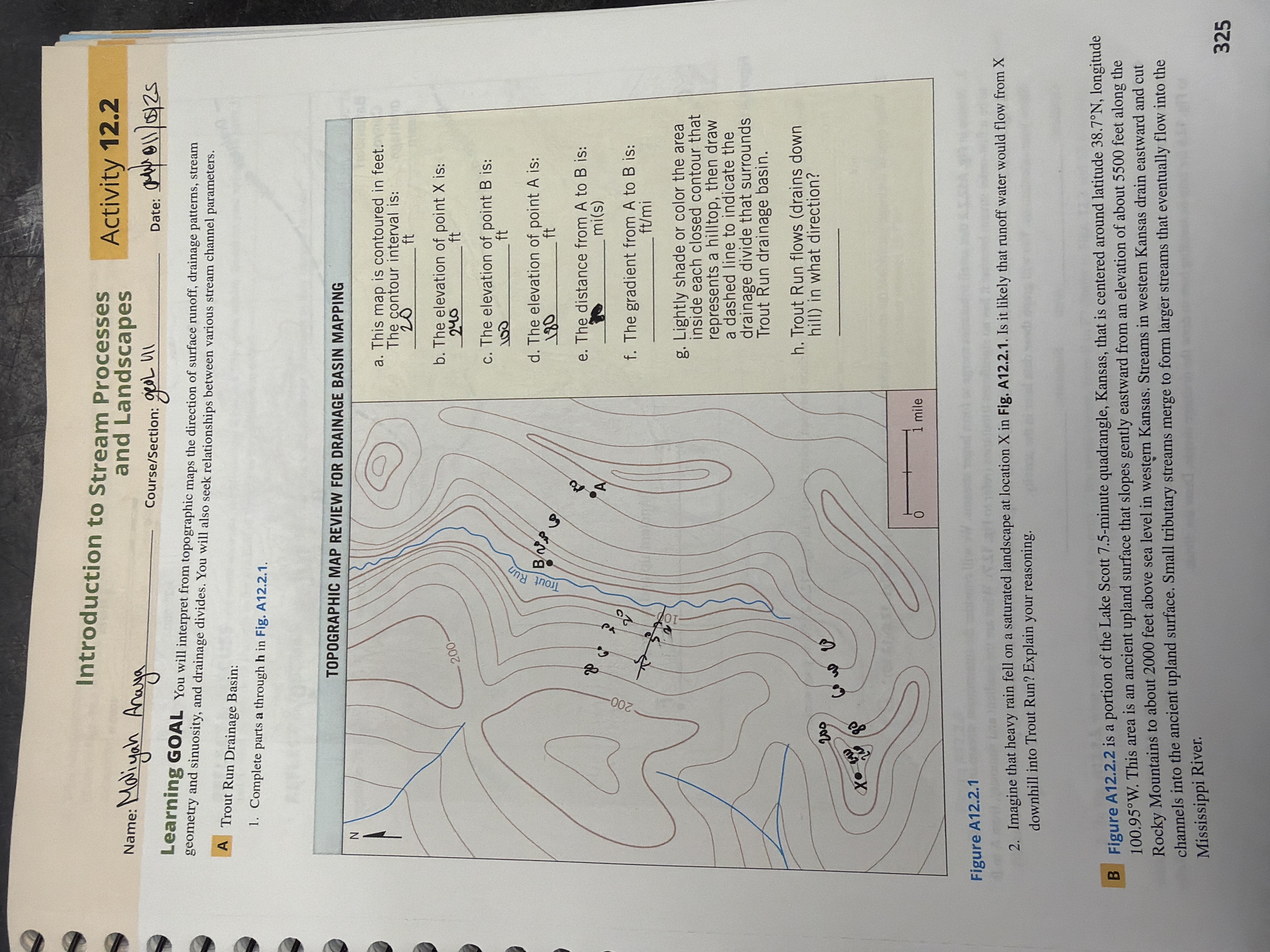
Introduction to Stream Processes Name : Moviyah Anaya and Landscapes Activity 12.2 Course/Section: geoL ul Date : Moll / 05/ 25 Learning GOAL You will interpret from topographic maps the direction of surface runoff, drainage patterns, stream geometry and sinuosity, and drainage divides. You will also seek relationships between various stream channel parameters. A Trout Run Drainage Basin: 1. Complete parts a through h in Fig. A12.2.1. TOPOGRAPHIC MAP REVIEW FOR DRAINAGE BASIN MAPPING -Z a. This map is contoured in feet. The contour interval is: 20 ft 200 b. The elevation of point X is: c. The elevation of point B is: 100 Trout Run B/NY d. The elevation of point A is: 130 e. The distance from A to B is: A mi(s) 200 f. The gradient from A to B is: ft/mi g. Lightly shade or color the area inside each closed contour that represents a hilltop, then draw a dashed line to indicate the drainage divide that surrounds Trout Run drainage basin. h. Trout Run flows (drains down 200 hill) in what direction? 1 mile Figure A12.2.1 2. Imagine that heavy rain fell on a saturated landscape at location X in Fig. A12.2.1. Is it likely that runoff water would flow from X downhill into Trout Run? Explain your reasoning. B Figure A12.2.2 is a portion of the Lake Scott 7.5-minute quadrangle, Kansas, that is centered around latitude 38.7N, longitude 100.95.W. This area is an ancient upland surface that slopes gently eastward from an elevation of about 5500 feet along the Rocky Mountains to about 2000 feet above sea level in western Kansas. Streams in western Kansas drain eastward and cut channels into the ancient upland surface. Small tributary streams merge to form larger streams that eventually flow into the Mississippi River. 325
Step by Step Solution
There are 3 Steps involved in it

Get step-by-step solutions from verified subject matter experts