

Question: 1. Use the elevations in Figure 7.12 as a guide for drawing contour lines. The 100-foot contour line is provided for reference. Using a
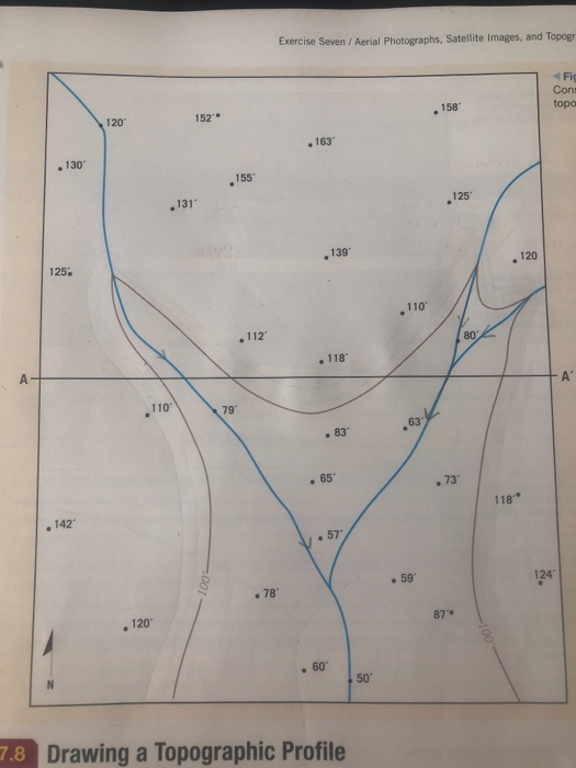
1. Use the elevations in Figure 7.12 as a guide for drawing contour lines. The 100-foot contour line is provided for reference. Using a 20-foot contour interval, use a pencil to draw a contour line for each 20-foot change in eleva- tion below and above 100 feet (e.g., 60 feet, 80 feet, 120 feet). You will have to estimate the elevations between the points. Label each contour line with its elevation. A ,130' 125 .142 120 110' , 120 131 152 100- 155' .112 79' .78' Exercise Seven / Aerial Photographs, Satellite Images, and Topogri . 163 . 139 . 118" 83 .65 60 . 57 7.8 Drawing a Topographic Profile 50 110' 63 . 59 158 125 87 80 118 120 124 Fig Cons topo A
Step by Step Solution
3.38 Rating (154 Votes )
There are 3 Steps involved in it
Answer A Rs132 Explanation ... View full answer

Get step-by-step solutions from verified subject matter experts