

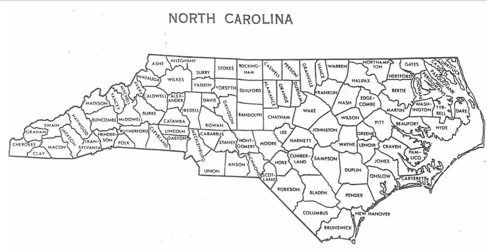
Question: A. Using the map of North Carolina provided develop a grid system showing clearly the X and Y coordinates used to locate the 10 counties
A. Using the map of North Carolina provided develop a grid system showing clearly the X and Y coordinates used to locate the 10 counties most populated counties. Since the domed stadium cannot be completed before 2025 use the North Carolina county population data for 2025 listed in the table provided.
B. Using the Center of Gravity technique determine the optimal mathematical location for the domed stadium. (Please Show work in Excel including formulas)
| County | Population July 2025 |
| Mecklenburg | 1223734 |
| Wake | 1199735 |
| Guilford | 555743 |
| Forsyth | 394665 |
| Durham | 342889 |
| Cumberland | 334207 |
| Buncombe | 273348 |
| Union | 260936 |
| New Hanover | 250814 |
| Johnston | 239055 |
Step by Step Solution
There are 3 Steps involved in it
1 Expert Approved Answer
Step: 1 Unlock

Question Has Been Solved by an Expert!
Get step-by-step solutions from verified subject matter experts
Step: 2 Unlock
Step: 3 Unlock