

Question: answer with excelsheet F10 A B C D E F G 1 Q2) The following table gives the map coordinates and the shipping loads for
answer with excelsheet 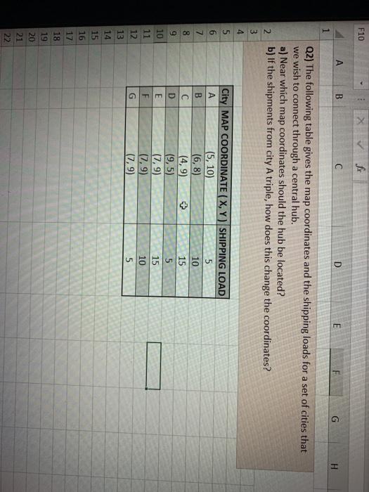
F10 A B C D E F G 1 Q2) The following table gives the map coordinates and the shipping loads for a set of cities that we wish to connect through a central hub. a) Near which map coordinates should the hub be located? b) If the shipments from city A triple, how does this change the coordinates? 2 3 4 5 6 7 8 City MAP COORDINATE (X,Y) SHIPPING LOAD (5, 10) 5 B (6,8) 10 C (4,9) 15 D (9,5) 5 E (7,9) 15 F (7,9) 10 G (7,9) 5 9 10 11 12 13 14 15 16 17 18 19 20 21 22
Step by Step Solution
There are 3 Steps involved in it
1 Expert Approved Answer
Step: 1 Unlock

Question Has Been Solved by an Expert!
Get step-by-step solutions from verified subject matter experts
Step: 2 Unlock
Step: 3 Unlock