

Question: C++ program: Hi, I need help. Thank you Portable Pix Map Image Format Specification The portable pix map image format (ppm) is one of the
C++ program:
Hi, I need help. Thank you
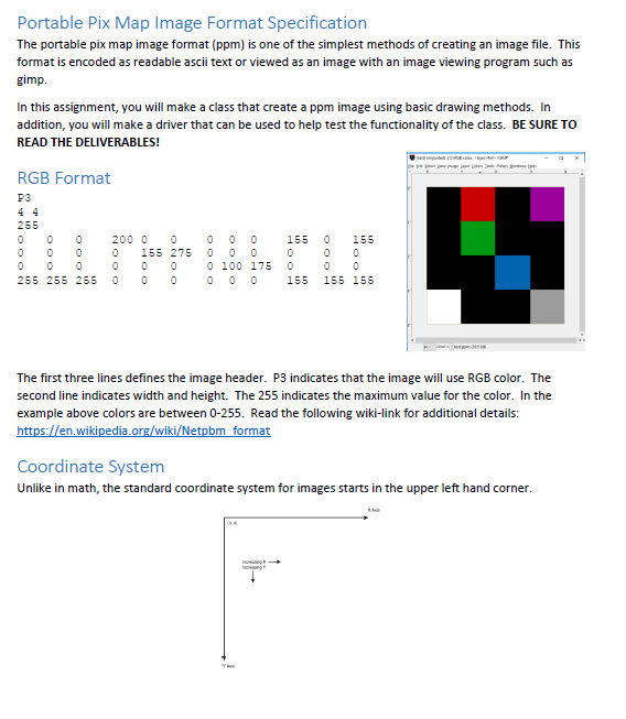
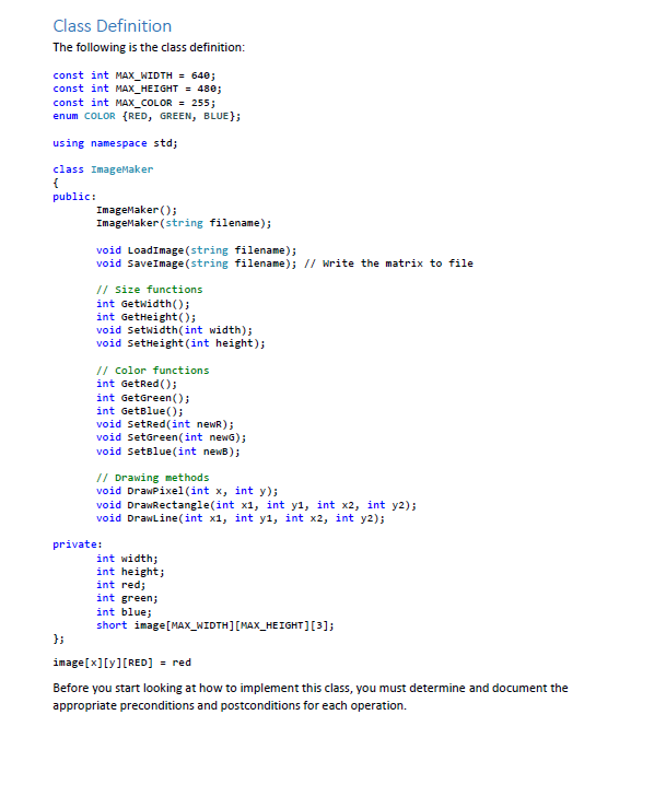
Portable Pix Map Image Format Specification The portable pix map image format (ppm) is one of the simplest methods of creating an image file. This format is encoded as readable ascii text or viewed as an image with an image viewing program such as gimp In this assignment, you will make a class that create a ppm image using basic drawing methods. In addition, you will make a driver that can be used to help test the functionality of the class. BE SURE TO READ THE DELIVERABLES! RGB Format P3 255 0 0 200 0 0 0 00155 275 0 000 0 0 0155 0 155 0 100 175 0 0 0 0155 155 155 255 255 255 0 0 0 The first three lines defines the image header. P3 indicates that the image will use RGB color. The second line indicates width and height. The 255 indicates the maximum value for the color. In the example above colors are between 0-255. Read the following wiki-link for additional details: en.wikipedia Coordinate System Unlike in math, the standard coordinate system for images starts in the upper left hand corner Portable Pix Map Image Format Specification The portable pix map image format (ppm) is one of the simplest methods of creating an image file. This format is encoded as readable ascii text or viewed as an image with an image viewing program such as gimp In this assignment, you will make a class that create a ppm image using basic drawing methods. In addition, you will make a driver that can be used to help test the functionality of the class. BE SURE TO READ THE DELIVERABLES! RGB Format P3 255 0 0 200 0 0 0 00155 275 0 000 0 0 0155 0 155 0 100 175 0 0 0 0155 155 155 255 255 255 0 0 0 The first three lines defines the image header. P3 indicates that the image will use RGB color. The second line indicates width and height. The 255 indicates the maximum value for the color. In the example above colors are between 0-255. Read the following wiki-link for additional details: en.wikipedia Coordinate System Unlike in math, the standard coordinate system for images starts in the upper left hand corner
Step by Step Solution
There are 3 Steps involved in it

Get step-by-step solutions from verified subject matter experts