

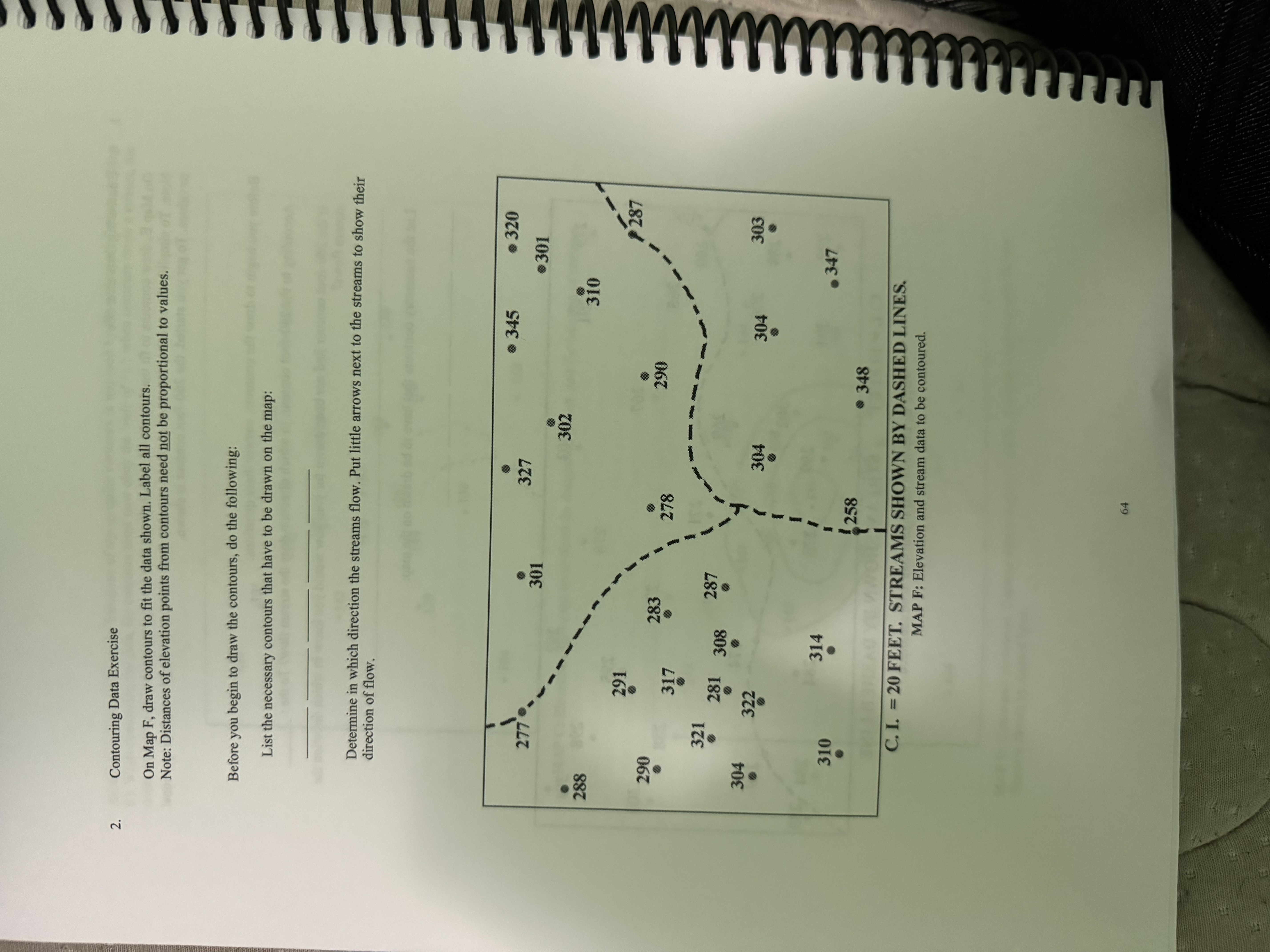
Question: Contouring Data Exercise On Map F , draw contours to fit the data shown. Label all contours. Note: Distances of elevation points from contours need
Contouring Data Exercise
On Map F draw contours to fit the data shown. Label all contours.
Note: Distances of elevation points from contours need not be proportional to values.
Before you begin to draw the contours, do the following:
List the necessary contours that have to be drawn on the map:
Determine in which direction the streams flow. Put little arrows next to the streams to show their direction of flow.
Step by Step Solution
There are 3 Steps involved in it
1 Expert Approved Answer
Step: 1 Unlock

Question Has Been Solved by an Expert!
Get step-by-step solutions from verified subject matter experts
Step: 2 Unlock
Step: 3 Unlock