

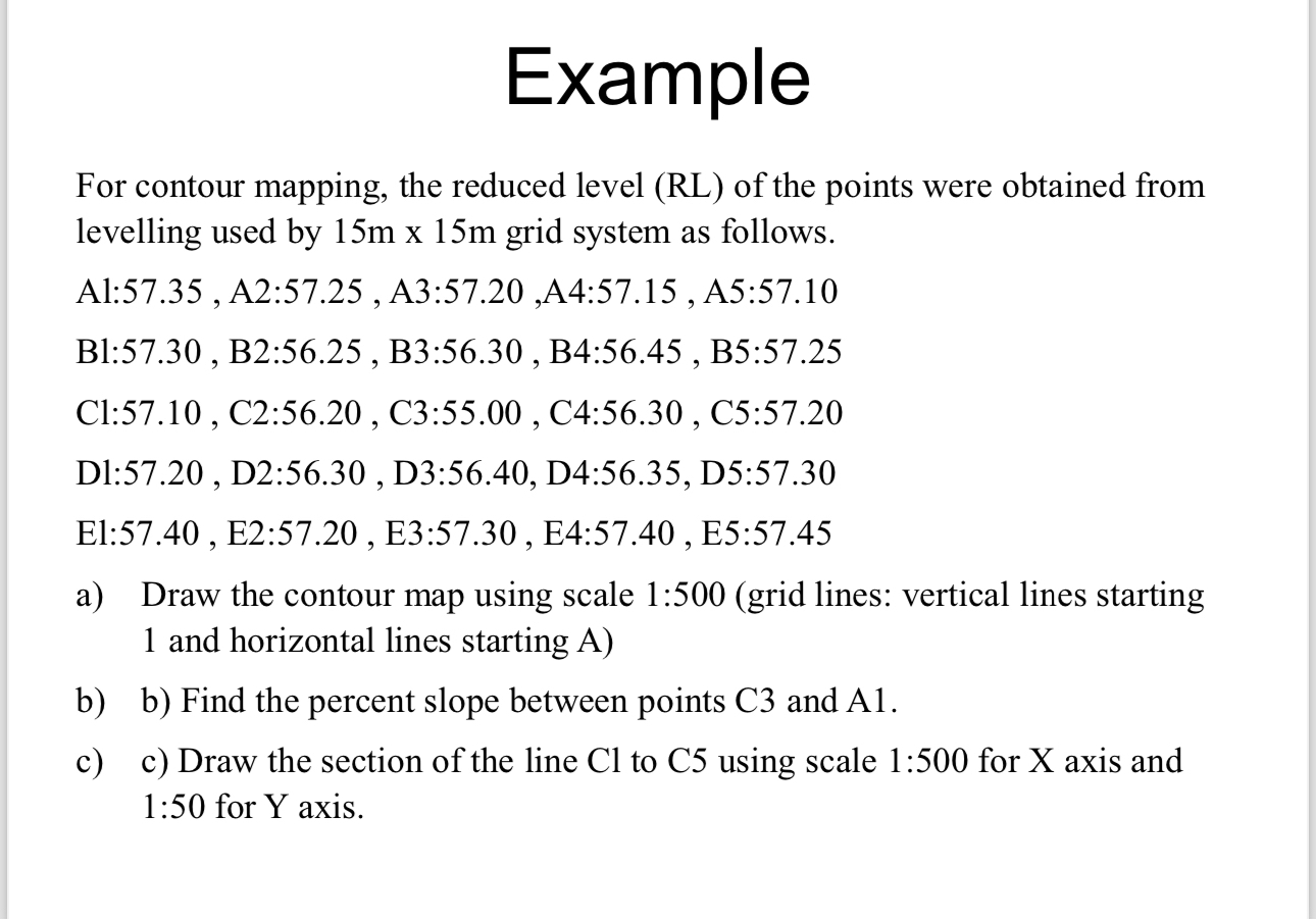
Question: Example For contour mapping, the reduced level ( RL ) of the points were obtained from levelling used by 1 5 m 1 5 m
Example
For contour mapping, the reduced level RL of the points were obtained from levelling used by grid system as follows.a Draw the contour map using scale :grid lines: vertical lines starting and horizontal lines starting Ab b Find the percent slope between points C and Ac c Draw the section of the line Cl to C using scale : for X axis and : for Y axis.
Step by Step Solution
There are 3 Steps involved in it
1 Expert Approved Answer
Step: 1 Unlock

Question Has Been Solved by an Expert!
Get step-by-step solutions from verified subject matter experts
Step: 2 Unlock
Step: 3 Unlock