

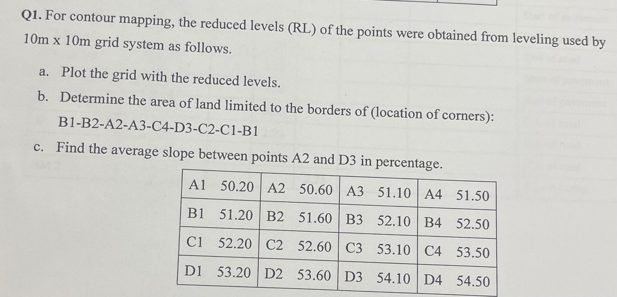
Question: Q 1 . For contour mapping, the reduced levels ( RL ) of the points were obtained from leveling used by 1 0 m 1
Q For contour mapping, the reduced levels RL of the points were obtained from leveling used by grid system as follows.
a Plot the grid with the reduced levels.
b Determine the area of land limited to the borders of location of corners:
BBAACDCCB
c Find the average slope between points and in percentage.
tableAAAABBBBCCCCDDDD
Step by Step Solution
There are 3 Steps involved in it
1 Expert Approved Answer
Step: 1 Unlock

Question Has Been Solved by an Expert!
Get step-by-step solutions from verified subject matter experts
Step: 2 Unlock
Step: 3 Unlock