

Question: Geography Coastal lab Questions for Map T-15 Point Reyes, CA Point Reyes National Seashore lies north of San Francisco on the California coast. Point Reyes
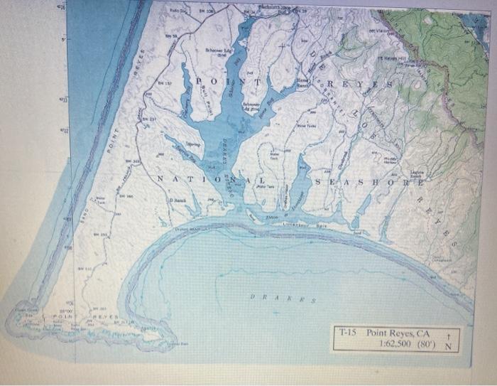
Questions for Map T-15 "Point Reyes, CA" Point Reyes National Seashore lies north of San Francisco on the California coast. Point Reyes consists of resistant bedrock that is being eroded by the forces of the sea. Emergent coastal features and recent tectonic activity characterize this active-margin coastline. Point Reyes is an area of rugged natural beauty with wind-sculpted trees, grasslands, rocky sea cliffs, and long sandy beaches. 1. What is the scale of the Point Reyes map? 2. What is the contour interval of the Point Reyes map? 3.What is the highest elevation shown on the map? 4.What is the general direction of the longshore current, and what coastal features would indicate this flow? 5. What did Drakes Estero used to be during the Ice Age? 6. in which side of Limantour Spit inorth or south! does deposition seem more prominent?
Step by Step Solution
3.44 Rating (157 Votes )
There are 3 Steps involved in it
Question 1 Scale of the map refers to the ratio of the distance represented on the map to the distan... View full answer

Get step-by-step solutions from verified subject matter experts