

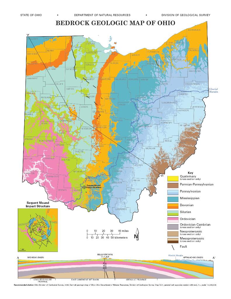
Question: Looking at the geologic map and the shaded elevation map side by side. Imagine where the glacial margin line would be on the shaded elevation
Looking at the geologic map and the shaded elevation map side by side. Imagine where the glacial margin line would be on the shaded elevation map and describe what is the relation between Question 13 and Question 14?
question 13: Compare the general topography in the NW corner of the state to the topography in the SE of the state.
question 14: Note the long, parallel ridges in the northwest of the state. What do those ridges represent? (Hint: read the second page of the map)
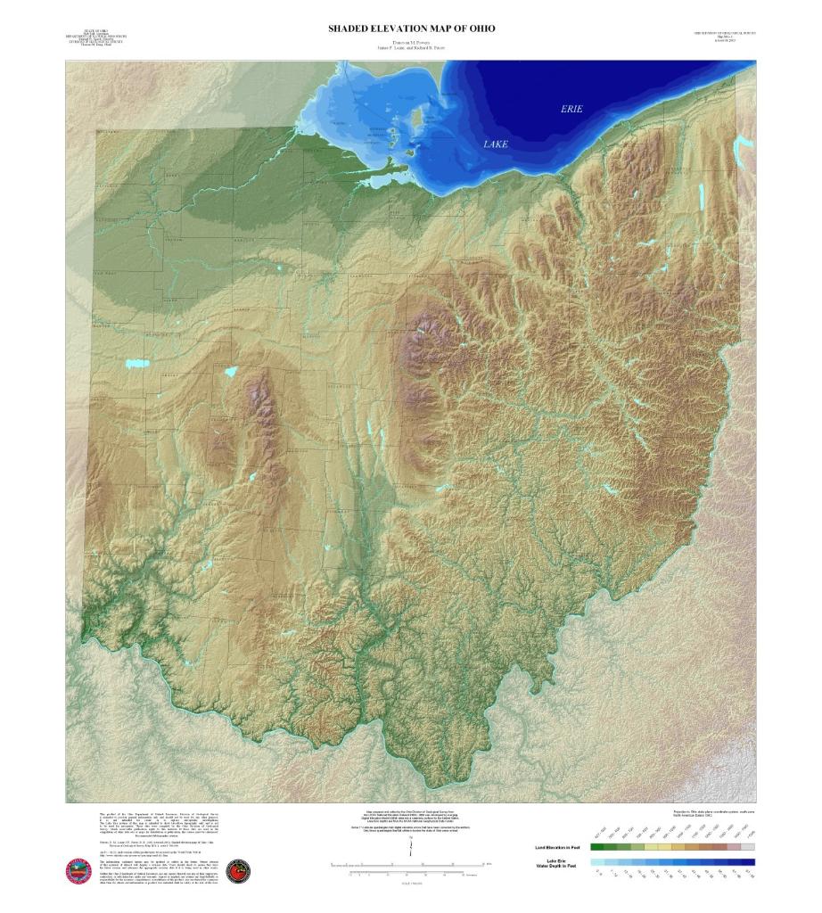
BO atten www www. The Tast H SHADED ELEVATION MAP OF OHIO VISA Wakal DMP her 14 LAKE ERIE Land Fer Like Bri Water Dein F
Step by Step Solution
3.39 Rating (155 Votes )
There are 3 Steps involved in it
Step 1 Both questions 13 and 14 are related to the bedrock topography and bedrock geolog... View full answer

Get step-by-step solutions from verified subject matter experts