

Question: Problem 3 The following network shows the major roads that would be part of the hurricane evacuation routes for Charleston, South Carolina: 2 The destination
Problem
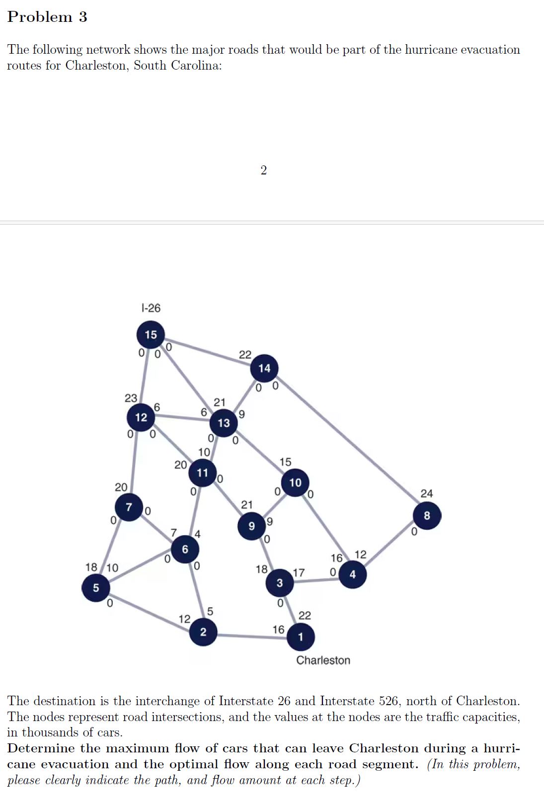
The following network shows the major roads that would be part of the hurricane evacuation routes for Charleston, South Carolina:
The destination is the interchange of Interstate and Interstate north of Charleston. The nodes represent road intersections, and the values at the nodes are the traffic capacities, in thousands of cars.
Determine the maximum flow of cars that can leave Charleston during a hurricane evacuation and the optimal flow along each road segment. In this problem, please clearly indicate the path, and flow amount at each step.
NOTE: To reduce the complexity, we will assume that items can flow only from nodes with lower numbers to nodes with higher numbers.
Step by Step Solution
There are 3 Steps involved in it
1 Expert Approved Answer
Step: 1 Unlock

Question Has Been Solved by an Expert!
Get step-by-step solutions from verified subject matter experts
Step: 2 Unlock
Step: 3 Unlock