

Question: Problem 8.20 The following table gives the map coordinates and the shipping loads for a set of cities that we wish to connect through a
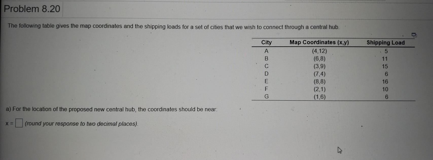
Problem 8.20 The following table gives the map coordinates and the shipping loads for a set of cities that we wish to connect through a central hub. City A B D E Map Coordinates (x,y) (4,12) (6,8) (3,9) (7,4) (8,8) (2,1) (1,6) Shipping Load 5 11 15 6 16 10 6 a) For the location of the proposed new central hub, the coordinates should be near. X= (round your response to two decimal places)
Step by Step Solution
There are 3 Steps involved in it
1 Expert Approved Answer
Step: 1 Unlock

Question Has Been Solved by an Expert!
Get step-by-step solutions from verified subject matter experts
Step: 2 Unlock
Step: 3 Unlock