

Question: Road Design assignment The objective of this assignment is to apply what you have learned to design a road connecting two existing roads. The attached
Road Design assignment
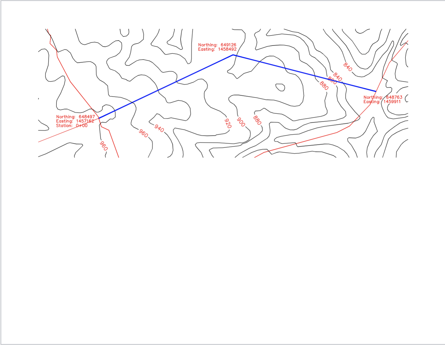
The objective of this assignment is to apply what you have learned to design a road connecting
two existing roads. The attached map shows the tangents in bold that you will use in your
design. You will need to design one horizontal curve and a complete vertical alignment.
Design criteria for the entire alignment
Design speed is
lane undivided road lane each direction with lanes.
The road should have shoulders.
ROW is
Crown: foot
Shoulder slope:
Maximum side slopes: :this is the slope from the shoulder to existing ground in Xsection
view If you need steeper than a : slope to meet existing ground, you will assume guard rail is
required. You'll need to identify what slope is required if steeper than : only for locations
where you draw cross sections see below
Maximum grades:
Maximum superelevation is
You should consider sight distance.
Note: the road should be near level at the intersections with the existing two roads.
Required
Plan and profile sheets of the horizontal and vertical alignment. This can be done directly on
the topo map provided or you may want to transfer to a separate sheet.
A sample plan and profile sheet is shown in Figure in the text.
All drawings must be drawn to scale make sure you specify the scale They should be neatly
drawn BY HAND using a straight edge and other drawing aids as appropriate.
Horizontal Alignment. For the horizontal alignment, the design should
be stationed appropriately, and include curve details. For stationing, I suggest tick marks every
and station labels every You must also include station labels at the PC PI PT etc.
Vertical Alignment. For the vertical alignment, your design should try to minimize
earthwork. You should exaggerate the vertical scale. Be sure to include the grades and critical
vertical curve info. You will likely need more than vertical curve.
Sample cross sections. You must include a sheets that show cross sections for station
the PC and first whole station after the PC Don't forget to consider superelevation. This
should on engineering paper.
Other. Make sure that you include any calculations that you made. You must show that you
have adequate sight distance through your vertical curves. One more note, you will need to
interpolate elevations from the contour map.
please show final design drawing
Step by Step Solution
There are 3 Steps involved in it
1 Expert Approved Answer
Step: 1 Unlock

Question Has Been Solved by an Expert!
Get step-by-step solutions from verified subject matter experts
Step: 2 Unlock
Step: 3 Unlock