

Question: The elevation of the ground surface at a soil - moisture measurement site is 3 0 0 cm . The soil is a sand, and
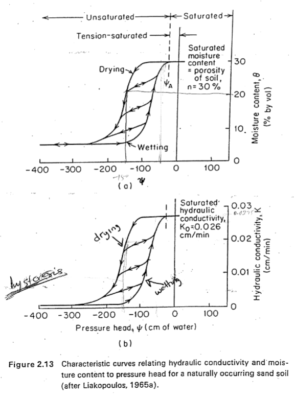
The elevation of the ground surface at a soilmoisture measurement site is cm The soil is a sand, and its unsaturated properties are represented by the drying curves in Figure handout
For each of the following scenarios a b and c below draw a quantitatively accurate set of vertical profiles for
i moisture content versus depth, ii pressure head versus depth, and iii hydraulic head versus depth for a
cm depth, as in Figure handout
Each profile should contain at least data points at depths cm below surface You may
use the measurement depth of cm as your datum Z
a The moisture content is throughout the profile.
b The pressure head is cm throughout the profile.
c The hydraulic head is cm throughout the profile static case
d For cases a and b calculate the i hydraulic gradients and ii rates of flow through the profile assume area m
Step by Step Solution
There are 3 Steps involved in it
1 Expert Approved Answer
Step: 1 Unlock

Question Has Been Solved by an Expert!
Get step-by-step solutions from verified subject matter experts
Step: 2 Unlock
Step: 3 Unlock