

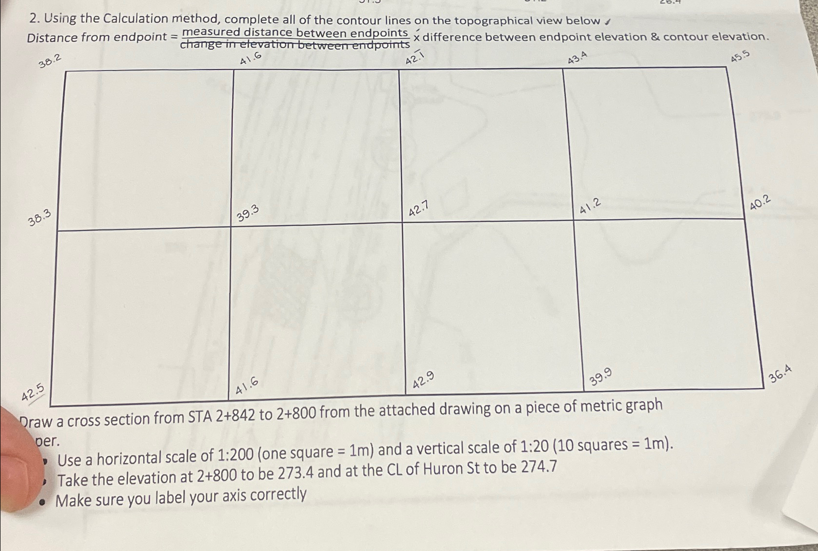
Question: Using the Calculation method, complete all of the contour lines on the topographical view below Distance from endpoint = m e a s u r
Using the Calculation method, complete all of the contour lines on the topographical view below
Distance from endpoint difference between endpoint elevation & contour elevation.
Draw a cross section from STA to from the attached drawing on a piece of metric graph oer.
Use a horizontal scale of :one square and a vertical scale of : squares
Take the elevation at to be and at the of Huron St to be
Make sure you label your axis correctly
Step by Step Solution
There are 3 Steps involved in it
1 Expert Approved Answer
Step: 1 Unlock

Question Has Been Solved by an Expert!
Get step-by-step solutions from verified subject matter experts
Step: 2 Unlock
Step: 3 Unlock