

Question: We have a graph which we will transfer the elevations to from the topographic map. The width of the grid should be the same
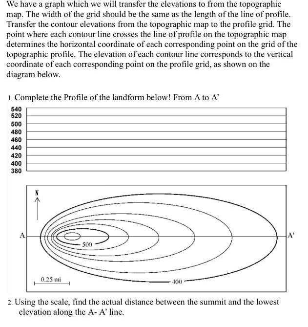
We have a graph which we will transfer the elevations to from the topographic map. The width of the grid should be the same as the length of the line of profile. Transfer the contour elevations from the topographic map to the profile grid. The point where each contour line crosses the line of profile on the topographic map determines the horizontal coordinate of each corresponding point on the grid of the topographic profile. The elevation of each contour line corresponds to the vertical coordinate of each corresponding point on the profile grid, as shown on the diagram below. 1. Complete the Profile of the landform below! From A to A' 540 520 500 480 460 440 420 400 380 A 0.25 mi 500 2. Using the scale, find the actual distance between the summit and the lowest elevation along the A- A' line.
Step by Step Solution
3.46 Rating (162 Votes )
There are 3 Steps involved in it
Step 12 1 The topographic profile has been described and illustrated in the image attached be... View full answer

Get step-by-step solutions from verified subject matter experts