

Figure G-59 contains a map showing the position of the Mendocino triple junction off the coast of
Question:
Figure G-59 contains a map showing the position of the Mendocino triple junction off the coast of northern California. The Mendocino triple junction is the point of intersection of the Pacific, North American, and Juan de Fuca Plates. Two earthquakes (event A and event B) occurred near the triple junction. They could have been centered on either of two transform boundaries or on the convergent boundary between the Juan de Fuca and North American Plates. The table presents data for the two earthquakes recorded at 25 seismic stations. Using two sheets of tracing paper (one sheet for each event) and your equal-area net (Fig. G-11), do the following: for each earthquake:
(1) Construct a focal-mechanism plot,
(2) Determine the plate boundary along which the earthquake occurred,
(3) Determine the attitude of the fault plane,
(4) Use arrows to show the slip sense along the fault, and
(5) Plot the P (shortening) and T (extension) axes.
Figure G-59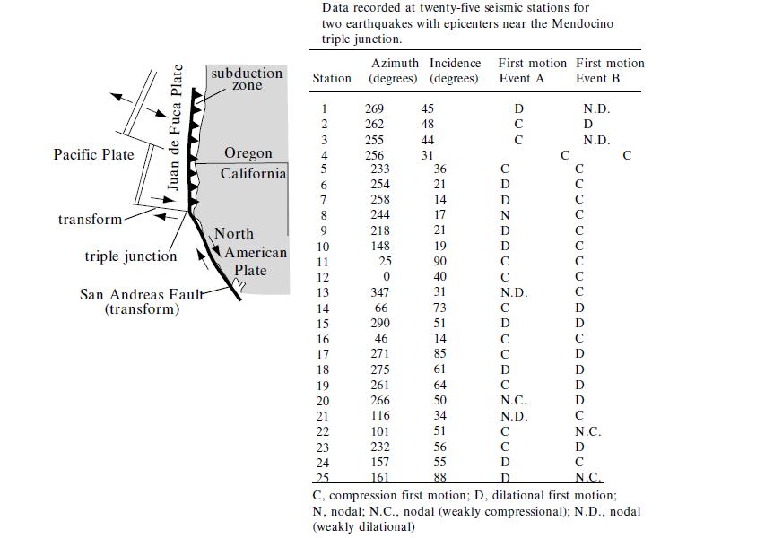
Fig. G-11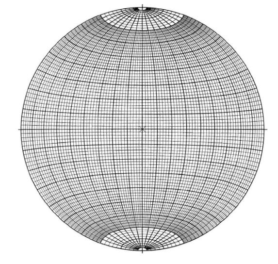
Step by Step Answer:

This question has not been answered yet.
You can Ask your question!

Structural Analysis And Synthesis A Laboratory Course In Structural Geology
ISBN: 9781405116527
3rd Edition
Authors: Stephen M. Rowland, Ernest M. Duebendorfer, Ilsa M. Schiefelbein
