

Question: ( 3 0 points ) A surface leveling exercise is shown in Figure 1 below. ( 2 0 points ) An open underground leveling exercise
points A surface leveling exercise is shown in Figure below. points An open underground leveling exercise is shown in Figure below.
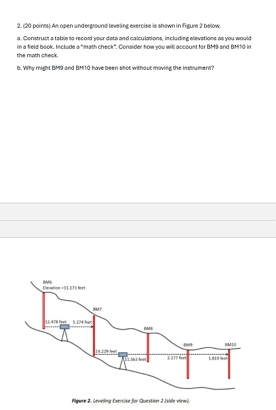
a Construct a table to record your data and calculations, including elevations as you would
in a field book. Include a "math check". Consider how you will account for BM and BM in
the math check.
b Why might BM and BM have been shot without moving the instrument?
Figure Leveling Exercise for Question side view
a Construct a table to record your data and calculations, including elevations as you would
in a field book. Include a "math check".
b What is the error of closure Hint: actual elevation of BM is known
c With what level of precision was this survey completed Excellent Ordinary....
d Determine adjusted elevations for each benchmark If the distances between Benchmarks
are as follows:
Step by Step Solution
There are 3 Steps involved in it
1 Expert Approved Answer
Step: 1 Unlock

Question Has Been Solved by an Expert!
Get step-by-step solutions from verified subject matter experts
Step: 2 Unlock
Step: 3 Unlock