

Question: SE 2 5 1 - Exercise ( 5 ) 1 - A horizontal ground distance of 1 2 5 0 . 0 0 m was
SE Exercise
A horizontal ground distance of was plotted on a map. The plotted map distance was found to be Determine the map scale. If a figure's area on the map is what would be its ground area in
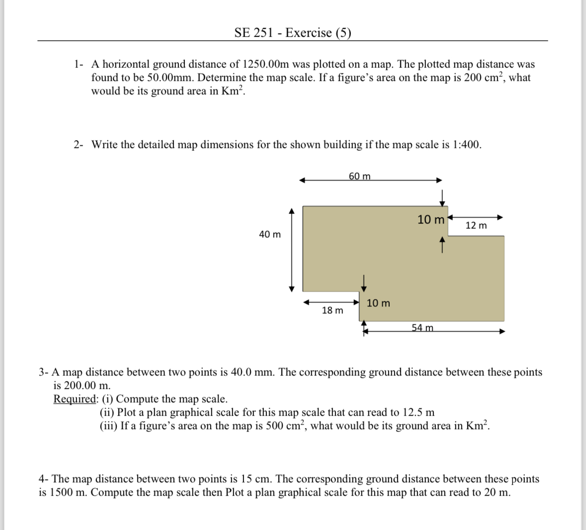
Write the detailed map dimensions for the shown building if the map scale is :
A map distance between two points is The corresponding ground distance between these points is
Required: i Compute the map scale.
ii Plot a plan graphical scale for this map scale that can read to
iii If a figure's area on the map is what would be its ground area in
The map distance between two points is The corresponding ground distance between these points is Compute the map scale then Plot a plan graphical scale for this map that can read to
Step by Step Solution
There are 3 Steps involved in it
1 Expert Approved Answer
Step: 1 Unlock

Question Has Been Solved by an Expert!
Get step-by-step solutions from verified subject matter experts
Step: 2 Unlock
Step: 3 Unlock