

Question: Thank you so much The figure below shows two ground-based radar stations tracking an air- craft. Station I has a fixed Cartesian stem (Oryz) attached
Thank you so much
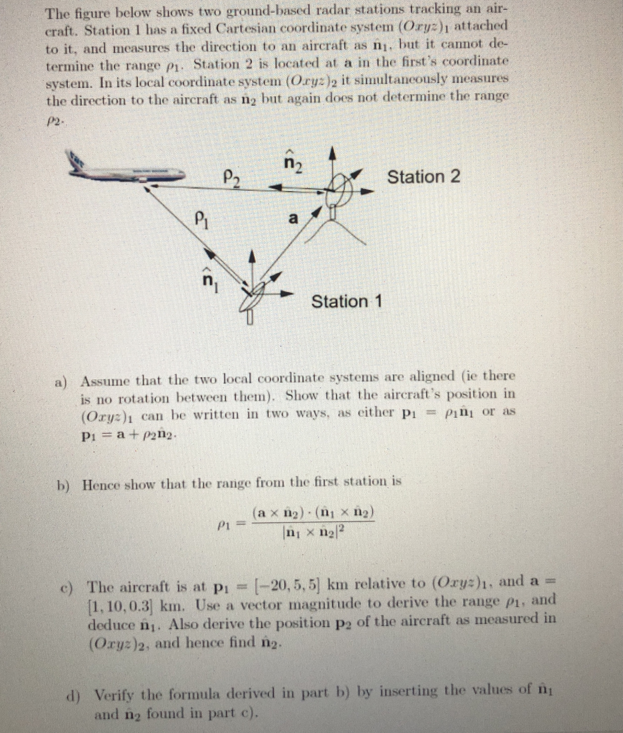
The figure below shows two ground-based radar stations tracking an air- craft. Station I has a fixed Cartesian "stem (Oryz) attached to it, and measures the direction to an aircraft as ni. but it cannot de- termine the range pi. 5 .. Station 2 is located at a in the first's coordinate system. In its local coordinate system (Orge )2 it simultaneously measures the direction to the aircraft as ng but again does not determine the range P2 -. P2 n2 Station 2 PI n Station 1 a) Assume that the two local coordinate systems are aligned (ie there is no rotation between them). Show that the aircraft's position in (Orgz)i can be written in two ways, as either pi == pini or as P1 = a + p212- b) Hence show that the range from the first station is PI (a x n2) . (1 x n2) n1 x 12 2 c) The aircraft is at pi = [-20, 5, 5] km relative to (Ory=)1, and a = [1. 10. 0.3] km. Use a vector magnitude to derive the range pi, and deduce nj. Also derive the position p2 of the aircraft as measured in (Orgz)2, and hence find n2.
Step by Step Solution
There are 3 Steps involved in it

Get step-by-step solutions from verified subject matter experts