

Question: The following table gives the map coordinates and the shipping loads for a set of cities that we wish to connect through a central hub.
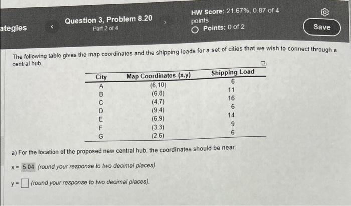
The following table gives the map coordinates and the shipping loads for a set of cities that we wish to connect through a central hub. a) For the location of the proposed new central hub, the coordinates should be near: x=5.04 (round your response to two decimal places). y= (round your response to two decimal places)
Step by Step Solution
There are 3 Steps involved in it
1 Expert Approved Answer
Step: 1 Unlock

To find the ycoordinate for the proposed central hub we use the weighted average m... View full answer
Question Has Been Solved by an Expert!
Get step-by-step solutions from verified subject matter experts
Step: 2 Unlock
Step: 3 Unlock