

Question: Using the topographic map below, answer the following questions. 1. What is the contour interval? 2. What general direction do the rivers run? 3.
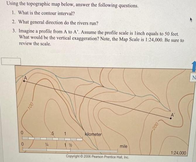
Using the topographic map below, answer the following questions. 1. What is the contour interval? 2. What general direction do the rivers run? 3. Imagine a profile from A to A'. Assume the profile scale is linch equals to 50 feet. What would be the vertical exaggeration? Note, the Map Scale is 1:24,000. Be sure to review the scale. A' kilometer 1 2 mile 1:24,000 Copyright 2006 Pearson Prentice Hall, Inc.
Step by Step Solution
3.41 Rating (145 Votes )
There are 3 Steps involved in it
1 Contour Interval 200 180 20 ft 2 The general direction of river run is westward ie from East to We... View full answer

Get step-by-step solutions from verified subject matter experts