

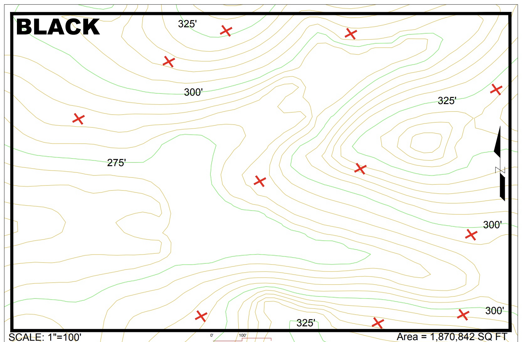
Question: Locate and label the elevation at the highest point on the mapLocate and label the elevation at the lowest point on the mapLabel the elevation
Locate and label the elevation at the highest point on the mapLocate and label the elevation at the lowest point on the mapLabel the elevation at each X location shown on the map Flow PathsLightly sketch where the main streams flowSketch the full flow path from each X location shown on the mapGo back to darken the main stream paths InterpolationLabel the elevation of each Confluence point
Step by Step Solution
There are 3 Steps involved in it
1 Expert Approved Answer
Step: 1 Unlock

Question Has Been Solved by an Expert!
Get step-by-step solutions from verified subject matter experts
Step: 2 Unlock
Step: 3 Unlock